
Image: Broutin-Ackia 4DFC49C
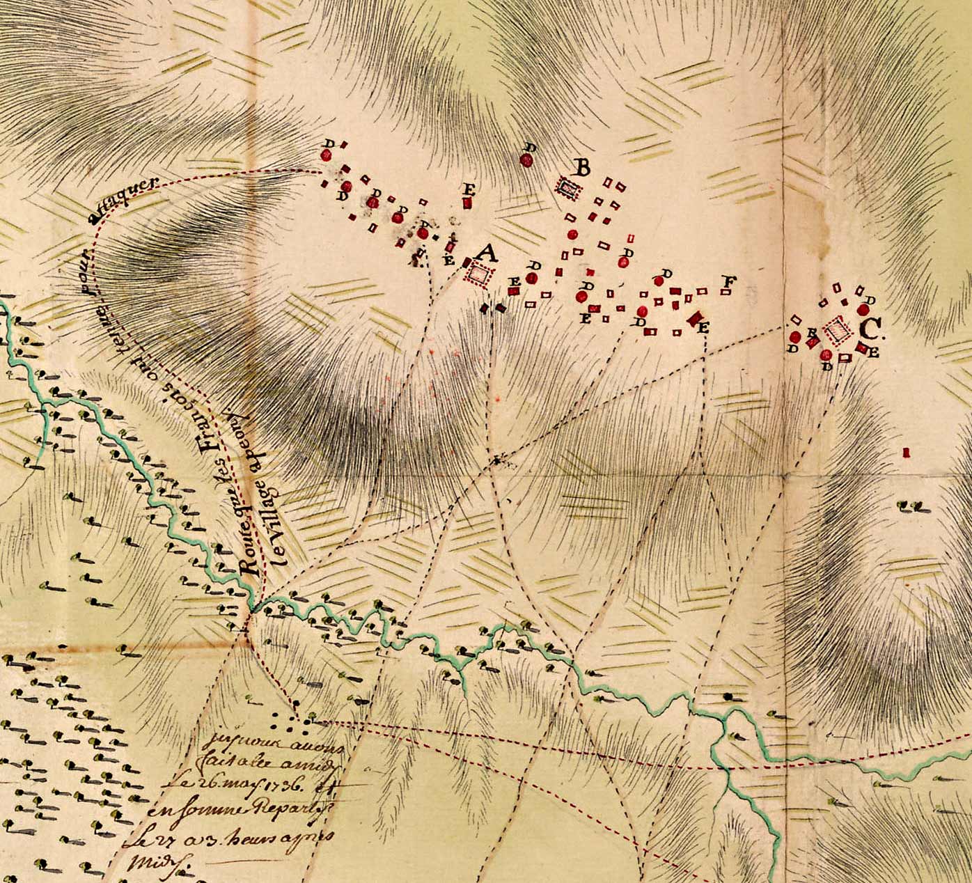
Description: Excerpt from 'Plan a L'Estime ou Scituation de Trois Villages Chicachas', by Ignace-François Broutin (28 June 1736). This remarkable map, made only a month after the event, depicts the French attack on the Chickasaw village of Ackia on the afternoon of 26 May 1736. Translation of the legend: A - Village of Ackia which was attacked. B - Fort Tchouka falaya. C - Fort Apeony where the English had a depot. D - Round fortified cabins. E - Rectangular fortified cabins. F - Fortified cabin (need translation). Centre des archives d'outre-mer (France), 04DFC 49C Front matter Conditions d'accès : Libre Conditions de reproduction : Libre Scale given in Toises, which are roughly equivalent to Fathoms, or 6 feet, or two meters
Title: Broutin-Ackia 4DFC49C
Credit: see above
Author: Unknown authorUnknown author
Usage Terms: Public domain
License: Public domain
Attribution Required?: No
Image usage
The following page links to this image:
