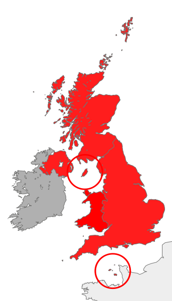
Image: British Islands

Size of this PNG preview of this SVG file: 343 × 600 pixels. Other resolution: 137 × 240 pixels.
Original image (SVG file, nominally 675 × 1,180 pixels, file size: 243 KB)
Description: map showing the territory referred to as "the British Islands" in relation to Great Britain and Ireland (namely the United Kingdom plus the Crown Dependencies, but not the Republic of Ireland)
Title: British Islands
Credit: Own work
Author: Cnbrb
Usage Terms: Public domain
License: Public domain
Attribution Required?: No
Image usage
The following page links to this image:

All content from Kiddle encyclopedia articles (including the article images and facts) can be freely used under Attribution-ShareAlike license, unless stated otherwise.
