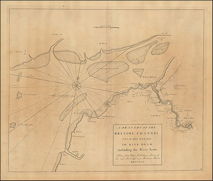
Image: Bristol Channel early 18th century

Size of this preview: 704 × 600 pixels. Other resolutions: 282 × 240 pixels | 2,231 × 1,900 pixels.
Original image (2,231 × 1,900 pixels, file size: 3.51 MB, MIME type: image/jpeg)
Description: This chart is based on a survey by Captain Anselm Holliday of Bristol (died 1729). It was published in an early 18th century maritime atlas.
Title: Bristol Channel early 18th century
Credit: https://www.raremaps.com/gallery/detail/47074/a-draught-of-the-bristol-channel-from-the-holmes-to-king-roa-senex-halley-cutler
Author: Usually attributed to John Senex, John Harris and Henry Wilson, also Nathanial Cutler. Survey work is by Captain Anselm Holliday, who died in 1729
Usage Terms: Public domain
License: Public domain
Attribution Required?: No
Image usage
The following page links to this image:

All content from Kiddle encyclopedia articles (including the article images and facts) can be freely used under Attribution-ShareAlike license, unless stated otherwise.
