
Image: Breckland Species Zonation and Soils - geograph.org.uk - 415797
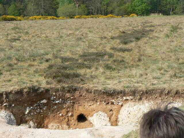
Description: Breckland Species Zonation and Soils This image shows a trench cut into the Heathland soils. This area is mostly underlaid by upper cretaceous chalk, though certain areas have been weathered in a systematic 'ridge and furrow' pattern. The furrows were filled in by periglacial aeolian (wind blown) sand deposits. This turns the soil more acidic, so favours species such as heather. Hence, the landscape alternates between calcareous grassland and strips of heather over relatively short distances.
Title: Breckland Species Zonation and Soils - geograph.org.uk - 415797
Credit: From geograph.org.uk
Author: Dan Friess
Usage Terms: Creative Commons Attribution-Share Alike 2.0
License: CC BY-SA 2.0
License Link: https://creativecommons.org/licenses/by-sa/2.0
Attribution Required?: Yes
Image usage
The following page links to this image:
