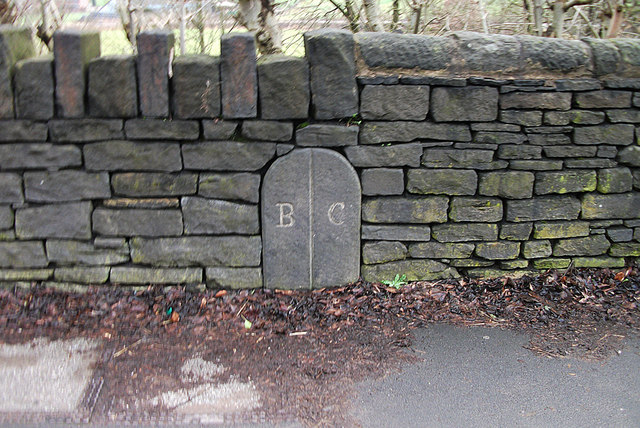
Image: Boundary marker between Butterworth and Crompton
Description: An archaic boundary marker on the A663 road between Newhey and Shaw and Crompton, in Greater Manchester, England. The "B" stands for "Butterworth", a defunct and ancient township in Rochdale parish; the "C" stands for "Crompton", a former township in Prestwich-cum-Oldham parish.
Title: Boundary marker between Butterworth and Crompton
Credit: http://www.geograph.org.uk/photo/2264297
Author: michael ely
Permission: This image was taken from the Geograph project collection. See this photograph's page on the Geograph website for the photographer's contact details. The copyright on this image is owned by michael ely and is licensed for reuse under the Creative Commons Attribution-ShareAlike 2.0 license. This file is licensed under the Creative Commons Attribution-Share Alike 2.0 Generic license. Attribution: michael ely You are free: to share – to copy, distribute and transmit the work to remix – to adapt the work Under the following conditions: attribution – You must attribute the work in the manner specified by the author or licensor (but not in any way that suggests that they endorse you or your use of the work). share alike – If you alter, transform, or build upon this work, you may distribute the resulting work only under the same or similar license to this one. http://creativecommons.org/licenses/by-sa/2.0 CC BY-SA 2.0 Creative Commons Attribution-Share Alike 2.0 truetrue
Usage Terms: Creative Commons Attribution-Share Alike 2.0
License: CC BY-SA 2.0
License Link: http://creativecommons.org/licenses/by-sa/2.0
Attribution Required?: Yes
Image usage
The following page links to this image:


