
Image: Boundary between Turkey and Armenia as determined by Woodrow Wilson 1920
Size of this preview: 609 × 599 pixels. Other resolutions: 244 × 240 pixels | 2,239 × 2,204 pixels.
Original image (2,239 × 2,204 pixels, file size: 8.19 MB, MIME type: image/jpeg)
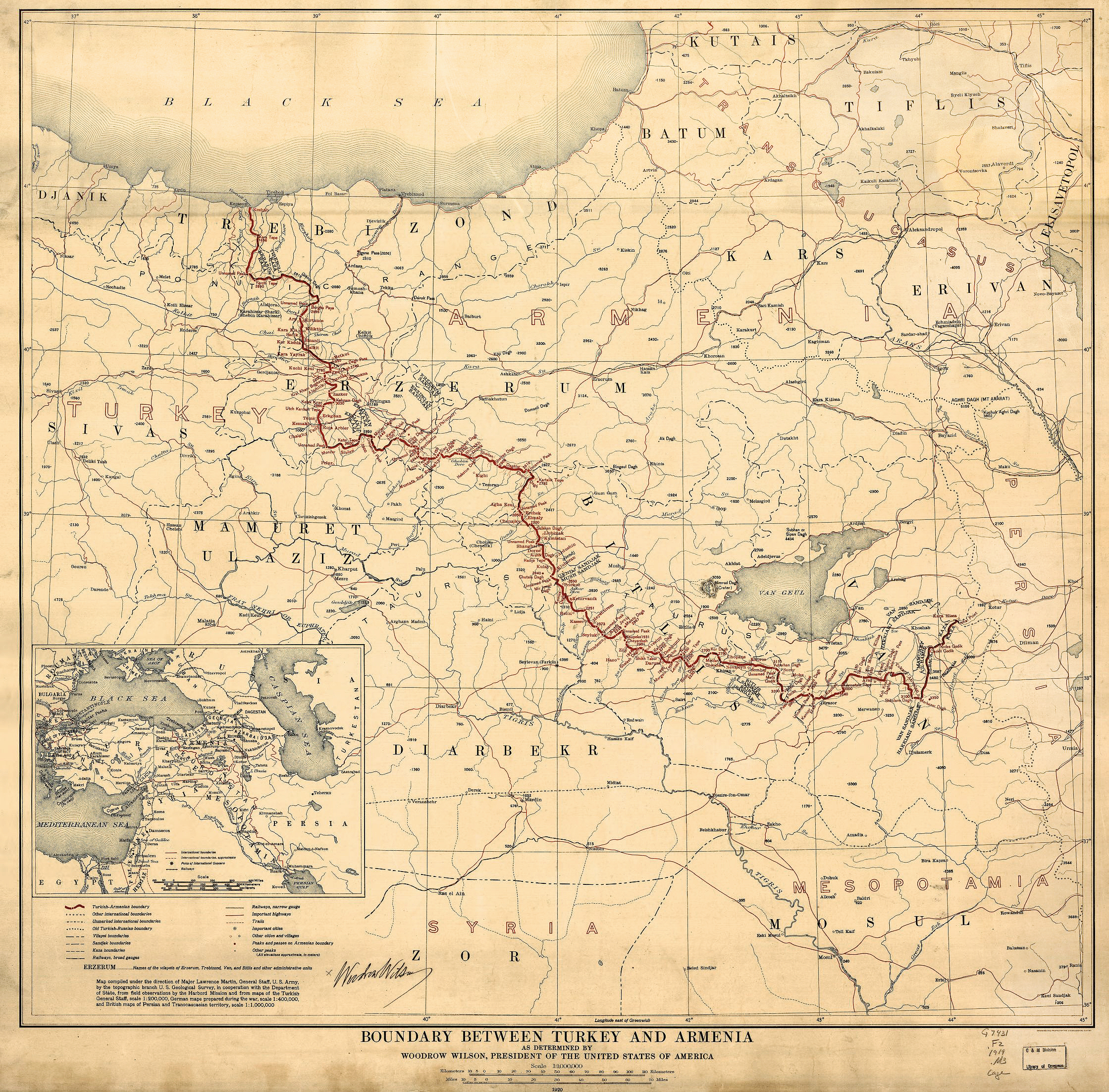
Description: Title Boundary between Turkey and Armenia : as determined by Woodrow Wilson, president of the United States of America / Description Scale 1:1,000,000. Relief shown by spot heights. From the President Woodrow Wilson papers. Available also through the Library of Congress Web site as a raster image. Includes location map. LC copy 2 signed by Woodrow Wilson. DLC 1 map : col. ; 70 x 74 cm.
Title: Boundary between Turkey and Armenia as determined by Woodrow Wilson 1920
Credit: Library of Congress
Author: Woodrow Wilson
Usage Terms: Public domain
License: Public domain
Attribution Required?: No
Image usage
The following 5 pages link to this image:

All content from Kiddle encyclopedia articles (including the article images and facts) can be freely used under Attribution-ShareAlike license, unless stated otherwise.