
Image: Bopha 2012-12-03 1712Z
Size of this preview: 450 × 600 pixels. Other resolutions: 180 × 240 pixels | 2,280 × 3,040 pixels.
Original image (2,280 × 3,040 pixels, file size: 1.8 MB, MIME type: image/jpeg)
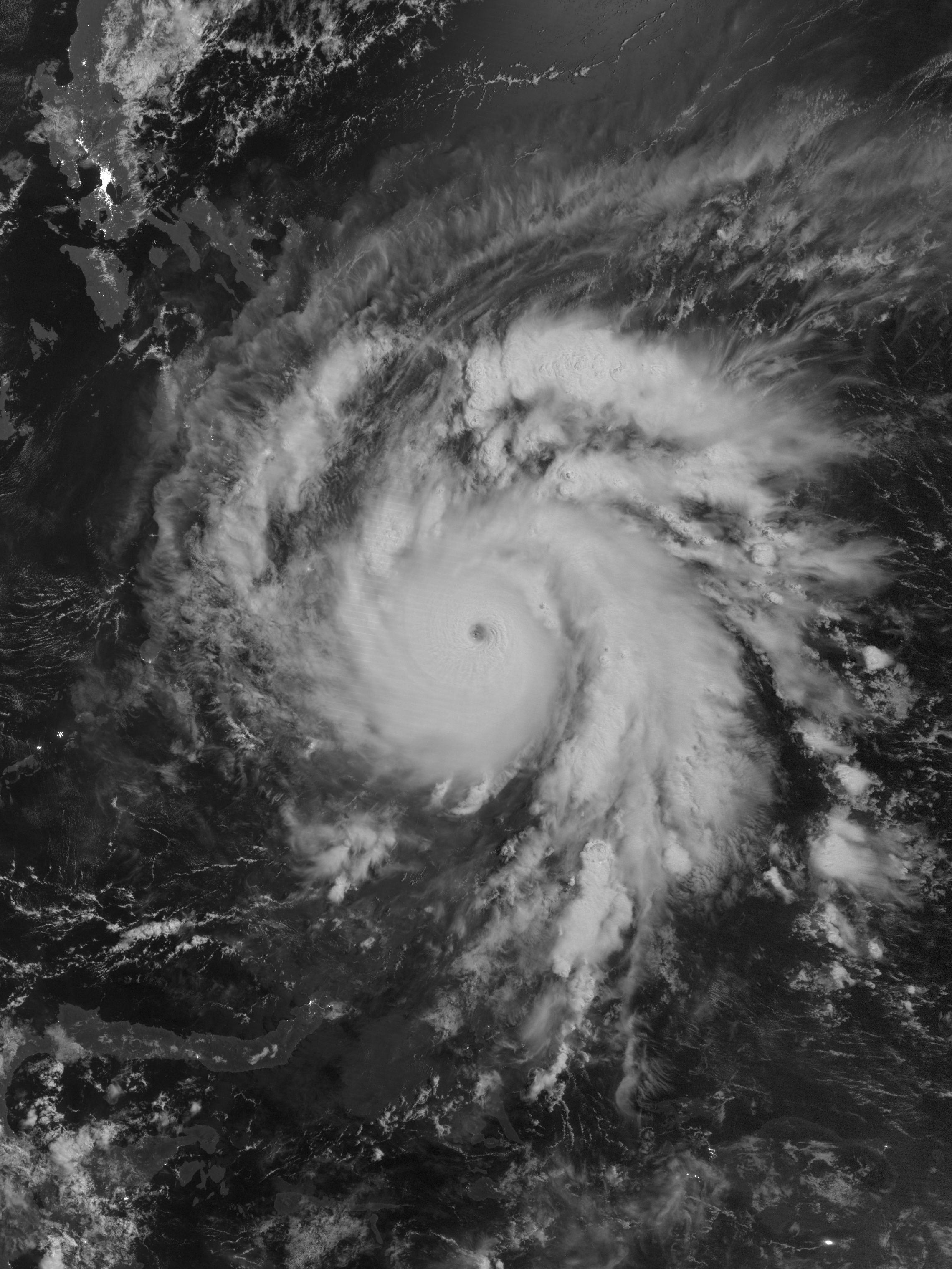
Description: The Suomi NPP satellite acquired this image of Typhoon Bopha around 01:12 local time on December 4 (17:12 UTC on December 3). Bopha remained a powerful typhoon as it made landfall on Mindanao, retaining a distinct eye and spiral shape as storm clouds stretched over the eastern part of the island. It was the deadliest tropical cyclone worldwide in 2012.
Title: Bopha 2012-12-03 1712Z
Credit: NASA Earth Observatory
Author: VIIRS Day-Night Band imagery captured by the Suomi NPP satellite
Usage Terms: Public domain
License: Public domain
Attribution Required?: No
Image usage
The following page links to this image:

All content from Kiddle encyclopedia articles (including the article images and facts) can be freely used under Attribution-ShareAlike license, unless stated otherwise.