
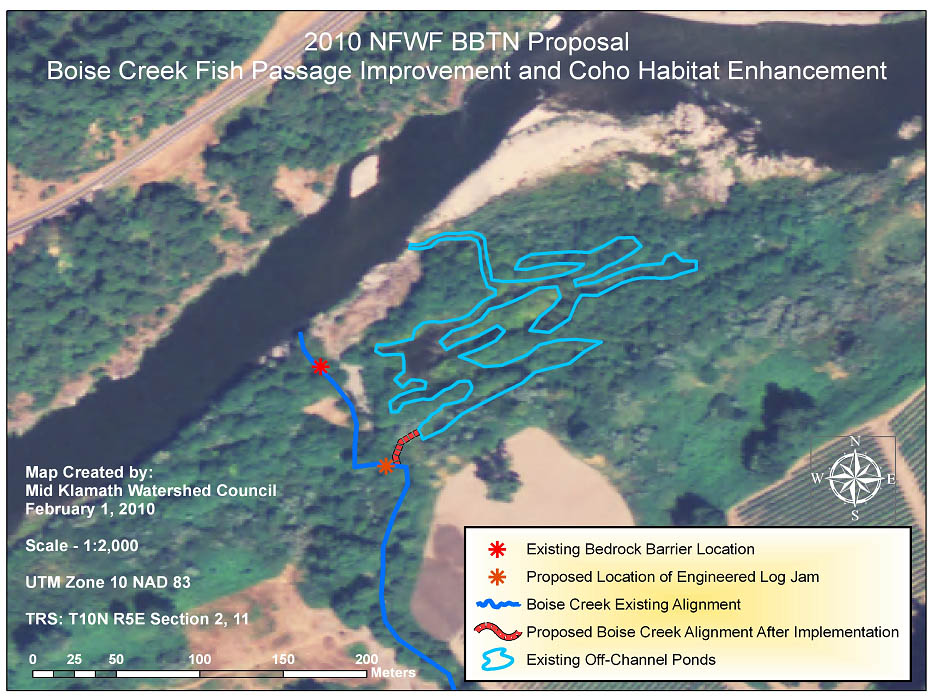
Image: Boise Creek Fish Passage Proposal Feb 2010
Size of this preview: 800 × 598 pixels. Other resolutions: 320 × 239 pixels | 934 × 698 pixels.
Original image (934 × 698 pixels, file size: 144 KB, MIME type: image/jpeg)
Description: Map of plan to bypass bedrock falls on Boise Creek to create wetlands and bypass the barrier to fish passage.
Title: Boise Creek Fish Passage Proposal Feb 2010
Credit: Emailed to me by the author
Author: Will Harling courtesy Mid-Klamath Watershed Council
Usage Terms: Creative Commons Attribution-Share Alike 3.0
License: CC BY-SA 3.0
License Link: https://creativecommons.org/licenses/by-sa/3.0
Attribution Required?: Yes
Image usage
The following page links to this image:

All content from Kiddle encyclopedia articles (including the article images and facts) can be freely used under Attribution-ShareAlike license, unless stated otherwise.