
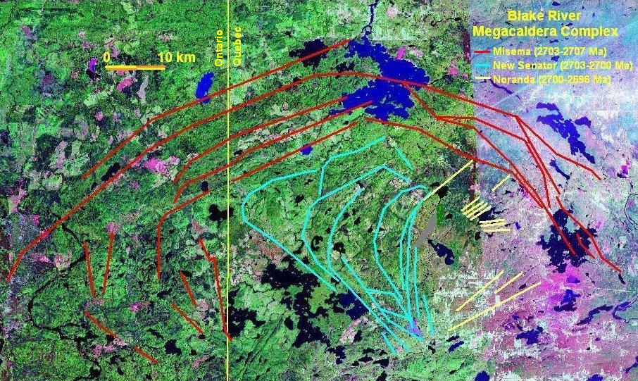
Image: Blake River Megacaldera Complex map
Size of this preview: 800 × 478 pixels. Other resolutions: 320 × 191 pixels | 906 × 541 pixels.
Original image (906 × 541 pixels, file size: 229 KB, MIME type: image/jpeg)
Description: Map of the Blake River Megacaldera Complex.
Title: Blake River Megacaldera Complex map
Credit: NASA World Wind
Author: NASA/Black Tusk
Permission: NASA, public domain
Usage Terms: Public domain
License: Public domain
Attribution Required?: No
Image usage
The following 3 pages link to this image:

All content from Kiddle encyclopedia articles (including the article images and facts) can be freely used under Attribution-ShareAlike license, unless stated otherwise.