
Image: Blair's Landing Battlefield Louisiana
Size of this preview: 778 × 599 pixels. Other resolutions: 312 × 240 pixels | 1,350 × 1,040 pixels.
Original image (1,350 × 1,040 pixels, file size: 437 KB, MIME type: image/jpeg)
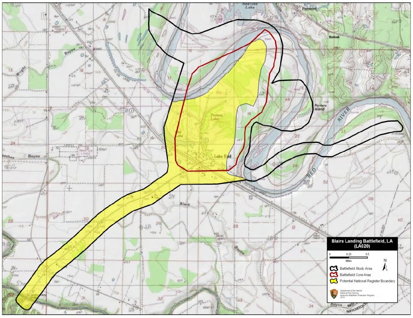
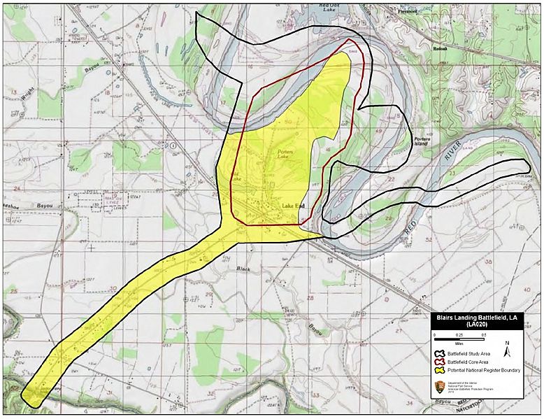
Description: Map of battlefield core and study areas. The ABPP adjusted the Study Area to conform to the course of the Red River c. 1864. Also, the ABPP added the approach route used by BG Thomas Green’s Cavalry Division. Green was attempting to intercept the Federal flotilla, which was slowly working its way down the Red River. The Core Area reflects the nearly two-mile front covered by the Federal gunboats and army transports as they moved down the river.
Title: Blair's Landing Battlefield Louisiana
Credit: National Park Service
Author: American Battlefield Protection Program
Usage Terms: Public domain
License: Public domain
Attribution Required?: No
Image usage
The following page links to this image:

All content from Kiddle encyclopedia articles (including the article images and facts) can be freely used under Attribution-ShareAlike license, unless stated otherwise.