Image: Blackcurramap
Blackcurramap.png (489 × 600 pixels, file size: 70 KB, MIME type: image/png)
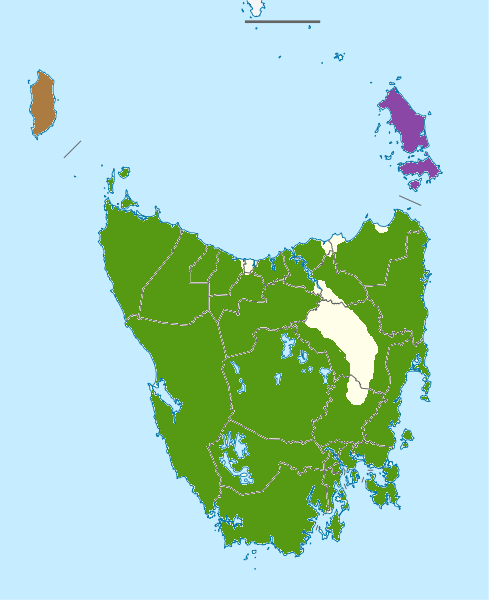
Description: Distribution map of Black Currawong (Strepera fuliginosa), derived from Higgins, Peter Jeffrey; Peter, John M.; Cowling, S.J. (eds.) (2006) Handbook of Australian, New Zealand and Antarctic Birds. Vol. 7: Boatbill to Starlings, Melbourne: Oxford University Press, p. 558 ISBN: 978-0195539967. . subspecies ▇ = fuliginosa, ▇ = colei (King Island), ▇ = parvior (Flinders Island)
Title: Blackcurramap
Credit: Own work
Author: Casliber
Usage Terms: Public domain
License: Public domain
Attribution Required?: No
Image usage
The following page links to this image:

All content from Kiddle encyclopedia articles (including the article images and facts) can be freely used under Attribution-ShareAlike license, unless stated otherwise.

