
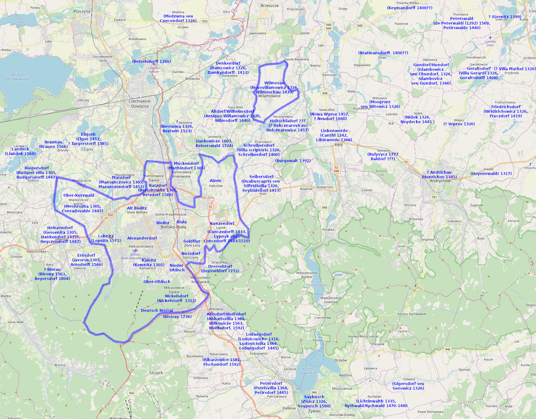
Image: Bielsko-Biała Language Island
Description: Bielsko-Biała German language island before WW2 (blue line), with some possible Walddeutsche settlements from the middle ages and later. The red line is the border between Silesia and Lesser Poland since the early 16th. Modern Bielsko-Biała borders in pink. Based on File:GermanHamletsSince15th.jpg and de:Liste mittelalterlicher Walddeutscher Siedlungen and [1], also: Robert Mrózek, Nazwy miejscowe Śląska Cieszyńskiego, 1984, and others. It is important to note that many of the mentions in German or Latin (which could indicate mixed population) were ephemeral or with only a singular occurence among numerous Slavic/Polish mentions [maybe because the scribe in Auschwitz/Oświęcim was German at the moment, or the ruler of a Slavic village was a German nobleman]. The Kurt Lück's map from 1934 was obviously exaggerated.
Title: Bielsko-Biała Language Island
Credit: Own work
Author: D T G
Usage Terms: Creative Commons Attribution-Share Alike 4.0
License: CC BY-SA 4.0
License Link: https://creativecommons.org/licenses/by-sa/4.0
Attribution Required?: Yes
Image usage
The following page links to this image:
