
Image: Bennington1777Map

Size of this preview: 767 × 600 pixels. Other resolutions: 307 × 240 pixels | 1,009 × 789 pixels.
Original image (1,009 × 789 pixels, file size: 658 KB, MIME type: image/png)
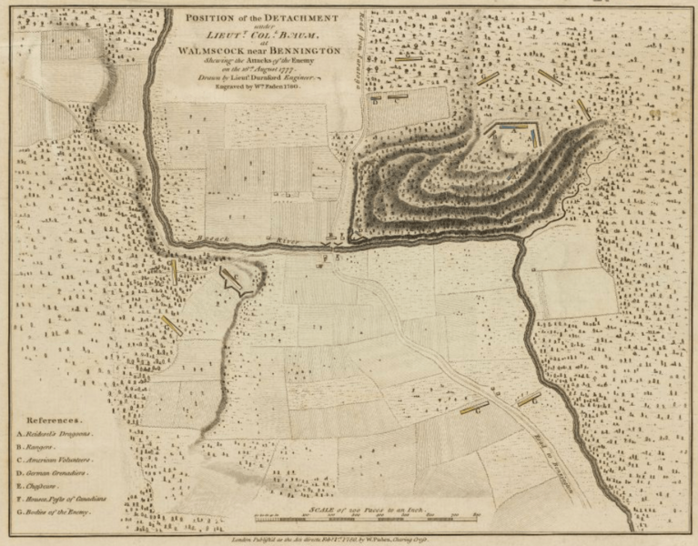
Description: This is a map depicting the positions of the opposing forces at the 1777 Battle of Bennington, which actually took place in Walloomsac. This image has been cropped to remove borders.
Title: Bennington1777Map
Credit: From the Online Maps Collection of the Boston Public Library. Call number: G3754.B5S3 1780 .D8 URL at time of upload: http://maps.bpl.org/details_10804/
Author: William Faden
Usage Terms: Public domain
License: Public domain
Attribution Required?: No
Image usage
The following page links to this image:

All content from Kiddle encyclopedia articles (including the article images and facts) can be freely used under Attribution-ShareAlike license, unless stated otherwise.