
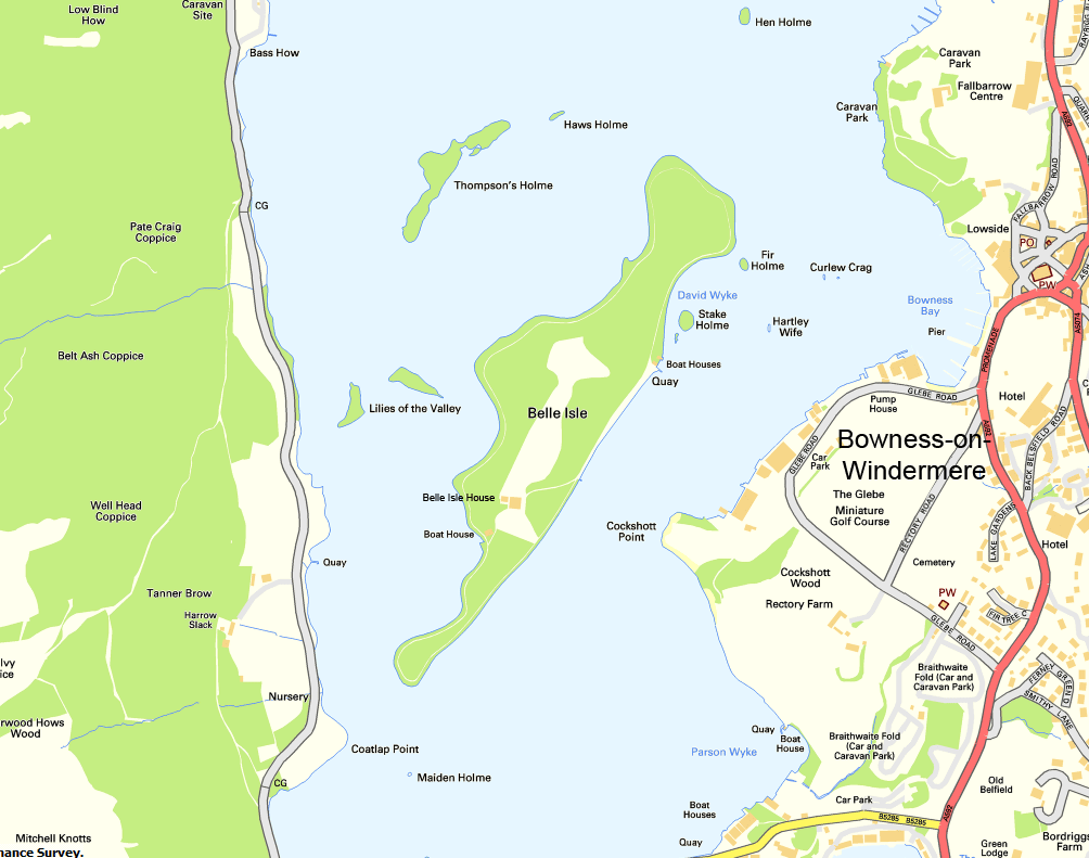
Image: Belle Isle Windermere map
Size of this preview: 761 × 600 pixels. Other resolutions: 305 × 240 pixels | 1,004 × 791 pixels.
Original image (1,004 × 791 pixels, file size: 108 KB, MIME type: image/png)
Description: Map of Belle Isle on Windermere
Title: Belle Isle Windermere map
Credit: Ordnance Survey Opendata
Author: OS OpenData with modifications by Prioryman
Permission: Note: Derivative works can be licensed under any Creative Commons Attribution 3.0 Licence.
Usage Terms: Ordnance Survey OpenData Licence
License: OS OpenData
License Link: https://www.ordnancesurvey.co.uk/business-and-government/licensing/using-creating-data-with-os-products/os-opendata.html
Attribution Required?: Yes
Image usage
The following page links to this image:

All content from Kiddle encyclopedia articles (including the article images and facts) can be freely used under Attribution-ShareAlike license, unless stated otherwise.