
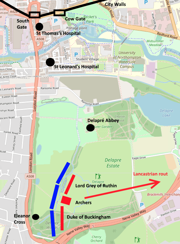
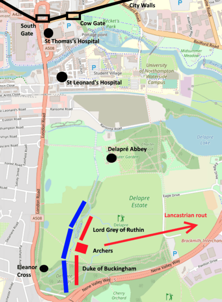
Image: Battle of Northampton 1460
Size of this preview: 442 × 599 pixels. Other resolutions: 177 × 240 pixels | 609 × 826 pixels.
Original image (609 × 826 pixels, file size: 149 KB, MIME type: image/png)
Description: Map showing the dispositions of the respective armies at the beginning of the Battle of Northampton, 10 July 1460. Map of Northampton is taken from OpenstreetMap ([1]); armies, walls, etc, taken from Kinross, J., Walking and Exploring the Battlefields of Britain (1988), p.80 and Ingram, M., The Battle of Northampton (2015), p.92.
Title: Battle of Northampton 1460
Credit: Own work
Author: Serial Number 54129
Usage Terms: Creative Commons Attribution-Share Alike 4.0
License: CC BY-SA 4.0
License Link: https://creativecommons.org/licenses/by-sa/4.0
Attribution Required?: Yes
Image usage
The following 2 pages link to this image:

All content from Kiddle encyclopedia articles (including the article images and facts) can be freely used under Attribution-ShareAlike license, unless stated otherwise.