
Image: Battle of Delium general map-fr

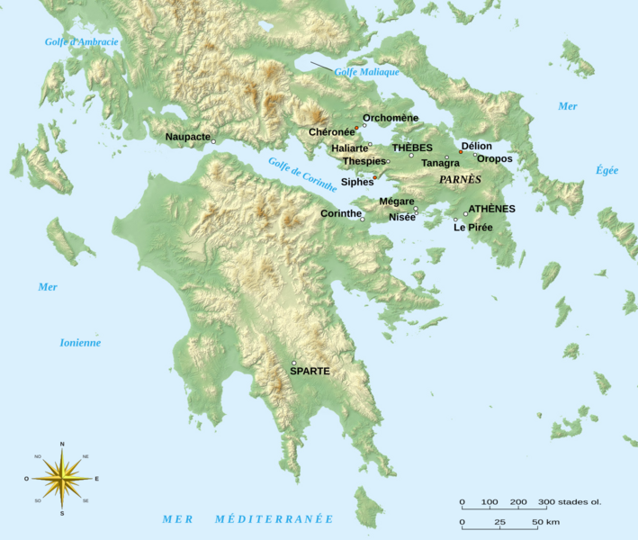
Description: Map in French showing a large part of Antic Greece with most of the cities and places involved in the Battle of Delium that occurred in 424BC during the Peloponnesian War.
Title: Battle of Delium general map-fr
Credit: Own work; Background map: NASA Shuttle Radar Topography Mission (SRTM3 v.2) (public domain) edited with 3DEM from Visualization Software LLC created by Richard Horne; References used for the Antic coastlines, Antic lakes and the localization of the cities: Barrington Atlas; Gustave Glotz, Histoire grecque – Des Origines aux Guerres médiques (t. 1), Presses Universitaires de France, 1948 (4th edition); Gasp. G. Mistardis, Recherches (hydrogéologiques) dans la région des lacs karstiques béotiens (École des Mines de Paris); Compass rose: Image:Brújula.svg (modified) created by Serg!o under GFDL.
Author: Eric Gaba (Sting - fr:Sting)
Permission: Attribution and Share-Alike required Any use of this map can be made as long as you credit me (Eric Gaba – Wikimedia Commons user: Sting) as the author, User:Serg!o for the compass rose, and distribute the copies and derivative works under the same license(s) that the one(s) stated below. A message with a reply address would also be greatly appreciated.
Usage Terms: Creative Commons Attribution-Share Alike 3.0
License: CC BY-SA 3.0
License Link: http://creativecommons.org/licenses/by-sa/3.0/
Attribution Required?: Yes
Image usage
The following page links to this image:
