
Image: Battle of Brier Creek Hollingsworth Map
Size of this preview: 446 × 599 pixels. Other resolutions: 178 × 240 pixels | 910 × 1,223 pixels.
Original image (910 × 1,223 pixels, file size: 508 KB, MIME type: image/jpeg)
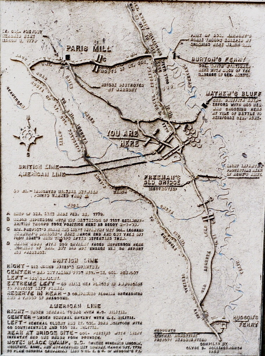
Description: Map of the March 3, 1779 Battle of Brier Creek. Created by Clyde D. Hollingsworth, it shows the movements of Royalist and Patriot forces along the Savannah River and Brier Creek. This picture was taken by the author's cousin W. Scottie Scott on March 3, 1007.
Title: Battle of Brier Creek Hollingsworth Map
Credit: Own work
Author: Dereddick (talk) (Uploads)
Usage Terms: Public domain
License: PD
Attribution Required?: No
Image usage
The following page links to this image:

All content from Kiddle encyclopedia articles (including the article images and facts) can be freely used under Attribution-ShareAlike license, unless stated otherwise.