
Image: Banten Sultanate en

Size of this PNG preview of this SVG file: 626 × 435 pixels. Other resolution: 320 × 222 pixels.
Original image (SVG file, nominally 626 × 435 pixels, file size: 253 KB)
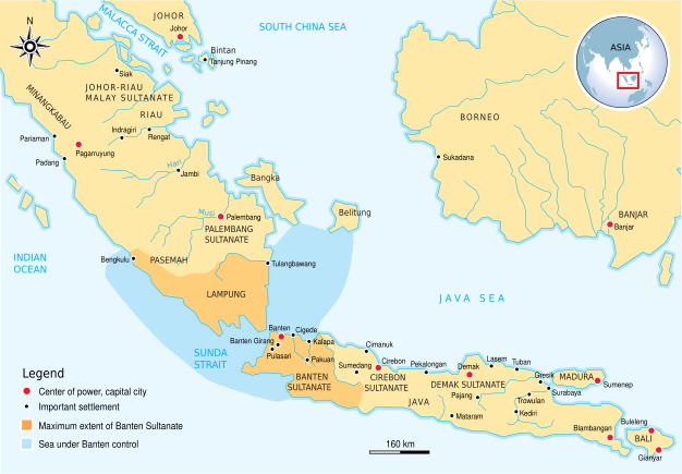
Description: The historical map of Banten Sultanate (1527–1813) Western Java. Made and improved based on "Atlas Sejarah Indonesia dan Dunia" (The Atlas of Indonesian and World History), PT Pembina Peraga Jakarta 1996.
Title: Banten Sultanate en
Credit: Own work
Author: Gunawan Kartapranata
Permission: I, the copyright holder of this work, hereby publish it under the following license:
Usage Terms: Creative Commons Attribution-Share Alike 3.0
License: CC BY-SA 3.0
License Link: https://creativecommons.org/licenses/by-sa/3.0
Attribution Required?: Yes
Image usage
The following page links to this image:

All content from Kiddle encyclopedia articles (including the article images and facts) can be freely used under Attribution-ShareAlike license, unless stated otherwise.