
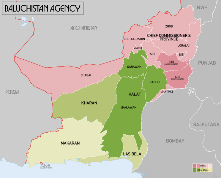
Image: Baluchistan Agency 1931 Map

Size of this preview: 744 × 600 pixels. Other resolutions: 298 × 240 pixels | 2,000 × 1,612 pixels.
Original image (2,000 × 1,612 pixels, file size: 125 KB, MIME type: image/png)
Description: Administrative map of British India's Baluchistan Agency in 1931. Source data: Survey of India 1:253k (Perry-Castenada Map Library, Univ of Texas), India 1:1M, Imperial Gazetteer of India 1:4M (Digital South Asia Library, Univ of Chicago).
Title: Baluchistan Agency 1931 Map
Credit: Own work
Author: XrysD
Usage Terms: Creative Commons Attribution-Share Alike 4.0
License: CC BY-SA 4.0
License Link: https://creativecommons.org/licenses/by-sa/4.0
Attribution Required?: Yes
Image usage
The following page links to this image:

All content from Kiddle encyclopedia articles (including the article images and facts) can be freely used under Attribution-ShareAlike license, unless stated otherwise.