
Image: Baltimore osm-mapnik location map
No higher resolution available.
Baltimore_osm-mapnik_location_map.png (490 × 475 pixels, file size: 349 KB, MIME type: image/png)
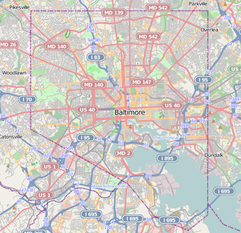
Description: Map of Baltimore Geographic limits of the map: N: 39.3805° S: 39.1953° W: -76.7426° E: -76.4957°
Title: Baltimore osm-mapnik location map
Credit: http://www.openstreetmap.org
Author: OpenStreetMap contributors
Permission: Cartography is licensed as CC-BY-SA (http://www.openstreetmap.org/copyright)
Usage Terms: Creative Commons Attribution-Share Alike 2.0
License: CC BY-SA 2.0
License Link: https://creativecommons.org/licenses/by-sa/2.0
Attribution Required?: Yes
Image usage
More than 100 pages link to this image. The following list shows the first 100 page links to this image only. A full list is available.
- American Brewery (building)
- Arlington, Baltimore
- Ashburton, Baltimore
- B&O Railroad Museum
- Baltimore Belt Line
- Baltimore City Circuit Courthouses
- Baltimore Equitable Society
- Battle Monument
- Bayview, Baltimore
- Berea, Baltimore
- Broadway East, Baltimore
- Butchers Hill, Baltimore
- Canton, Baltimore
- Carroll Mansion
- Carrollton Viaduct
- Chinatown, Baltimore
- Clifton Park, Baltimore
- Coca-Cola Bottling Company of Baltimore Building
- Coldstream-Homestead-Montebello, Baltimore
- Curtis Bay, Baltimore
- Cylburn Arboretum
- Dorchester, Baltimore
- Downtown Baltimore
- Druid Hill Park
- Eastern Female High School
- Eastern High School (Maryland)
- Edmondson Avenue Historic District
- Elmer V. McCollum House
- Eutaw Place Temple
- Federal Hill, Baltimore
- Federal Reserve Bank of Richmond Baltimore Branch
- Fell's Point, Baltimore
- Fifth Regiment Armory
- First Presbyterian Church and Manse (Baltimore, Maryland)
- First Unitarian Church (Baltimore, Maryland)
- Franklin Street Presbyterian Church and Parsonage
- Friends Burial Ground (Baltimore, Maryland)
- Greektown, Baltimore
- Gunther Brewing Company
- H. L. Mencken House
- Halethorpe, Maryland
- Hamilton Hills, Baltimore
- Hampden, Baltimore
- Hebrew Orphan Asylum (Baltimore, Maryland)
- Hendler Creamery
- Henry August Rowland House
- Highlandtown, Baltimore
- Inner Harbor
- Ira Remsen House
- Langston Hughes, Baltimore
- Leadenhall Street Baptist Church
- Lion Brothers Company Building
- Little Montgomery Street Historic District
- Lloyd Street Synagogue
- Locust Point, Baltimore
- Logan Field (Maryland)
- Lyric Performing Arts Center
- Madison-Eastend, Baltimore
- McElderry Park, Baltimore
- Merchants' National Bank Building (1895), Baltimore
- Middle East, Baltimore
- Midtown-Edmondson, Baltimore
- Milton-Montford, Baltimore
- Mount Royal Station
- Mount Washington, Baltimore
- NS Savannah
- National Brewing Company
- National Shrine of St. Alphonsus Liguori
- North Central Historic District (Baltimore, Maryland)
- Northwood, Baltimore
- Old West Baltimore Historic District
- Oliver, Baltimore
- Orchard Street United Methodist Church
- Otterbein Church (Baltimore, Maryland)
- Peale Museum
- Pennsylvania Station (Baltimore)
- Phoenix Shot Tower
- Pigtown, Baltimore
- Pratt Street Power Plant
- President Street Station
- Public School No. 111
- Reservoir Hill, Baltimore
- SS John W. Brown
- Sharp Street Memorial United Methodist Church and Community House
- St. James the Less Roman Catholic Church
- St. Leo's Church (Baltimore, Maryland)
- St. Paul's Church Rectory
- St. Paul's Episcopal Church (Baltimore, Maryland)
- St. Peter the Apostle Church
- Stonewood-Pentwood-Winston, Baltimore
- USCGC Taney
- USS Torsk
- United States Coast Guard Yard
- United States Custom House (Baltimore)
- United States lightship Chesapeake (LV-116)
- Upton, Baltimore
- Westminster Hall and Burying Ground
- Westport, Baltimore
- Wetheredsville, Maryland
- Woman's Industrial Exchange

All content from Kiddle encyclopedia articles (including the article images and facts) can be freely used under Attribution-ShareAlike license, unless stated otherwise.