
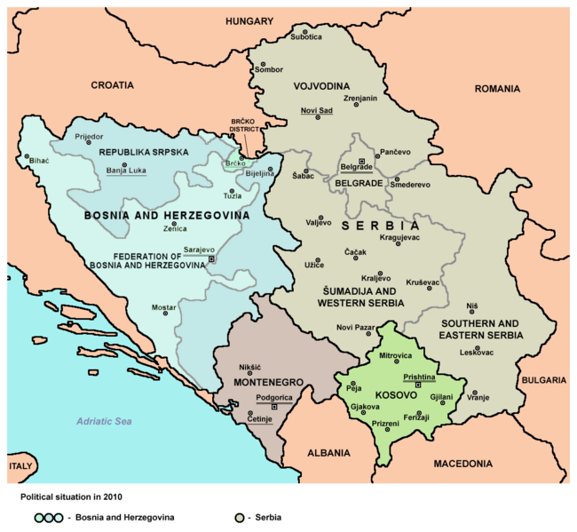
Image: Balkans2010

Size of this preview: 650 × 599 pixels. Other resolutions: 260 × 240 pixels | 1,128 × 1,040 pixels.
Original image (1,128 × 1,040 pixels, file size: 59 KB, MIME type: image/png)
Description: Map of Central Balkans in 2010 - showing Bosnia and Herzegovina, Serbia, Montenegro and Kosovo.
Title: Balkans2010
Credit: Own work
Author: PANONIAN
Usage Terms: Creative Commons Zero, Public Domain Dedication
License: CC0
License Link: http://creativecommons.org/publicdomain/zero/1.0/deed.en
Attribution Required?: No
Image usage
The following page links to this image:

All content from Kiddle encyclopedia articles (including the article images and facts) can be freely used under Attribution-ShareAlike license, unless stated otherwise.