
Image: BaldEagleFm narrows
Size of this preview: 800 × 125 pixels. Other resolutions: 320 × 50 pixels | 4,446 × 694 pixels.
Original image (4,446 × 694 pixels, file size: 595 KB, MIME type: image/jpeg)
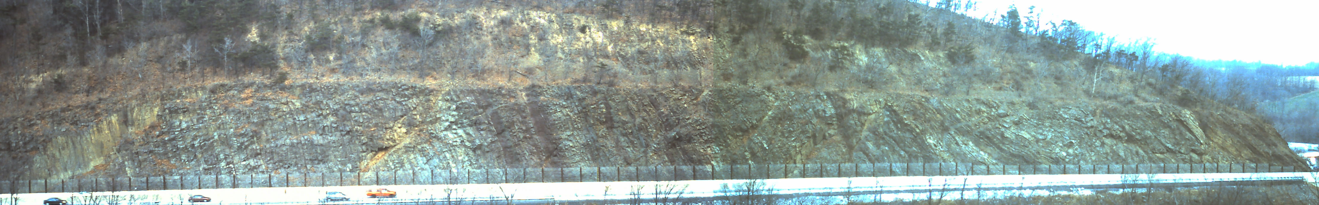
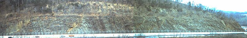
Description: A panorama of the Bald Eagle portion of the Narrows roadcut in Bedford County for the Pennsylvania Turnpike. Stratigraphic up is to the left (contact with Juniata Formation is just off the image), and thus the beds are overturned. The beds are highly folded and faulted at right. February 2001.
Title: BaldEagleFm narrows
Credit: Own work
Author: Jstuby at English Wikipedia
Usage Terms: Public domain
License: Public domain
Attribution Required?: No
Image usage
The following page links to this image:

All content from Kiddle encyclopedia articles (including the article images and facts) can be freely used under Attribution-ShareAlike license, unless stated otherwise.