
Image: Balch creek.census
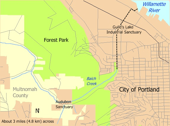
Description: Map of Balch Creek in Portland, Oregon, United States, showing part of Forest Park as well as the boundaries between the city and unincorporated parts of Multnomah County. The dashed black line shows the route of the storm sewer through which the creek flows from Lower Macleay Park to the Willamette River.
Title: Balch creek.census
Credit: Own work
Author: Taken from U.S. Census website here and modified by User:Finetooth. Stream locations added by hand using Hiking and Running Guide to Forest Park, a 10-map collection published by Friends of Forest Park, Portland, Ore., in 2003, and "The Forest Park Map" by Erik Goetze here.
Permission: U.S. government work in public domain; my modifications licensed under GFDL, CC-BY-SA-3.0
Usage Terms: Public domain
License: Public domain
Attribution Required?: No
Image usage
The following page links to this image:
