
Image: Badwater Basin - Flickr - Joe Parks
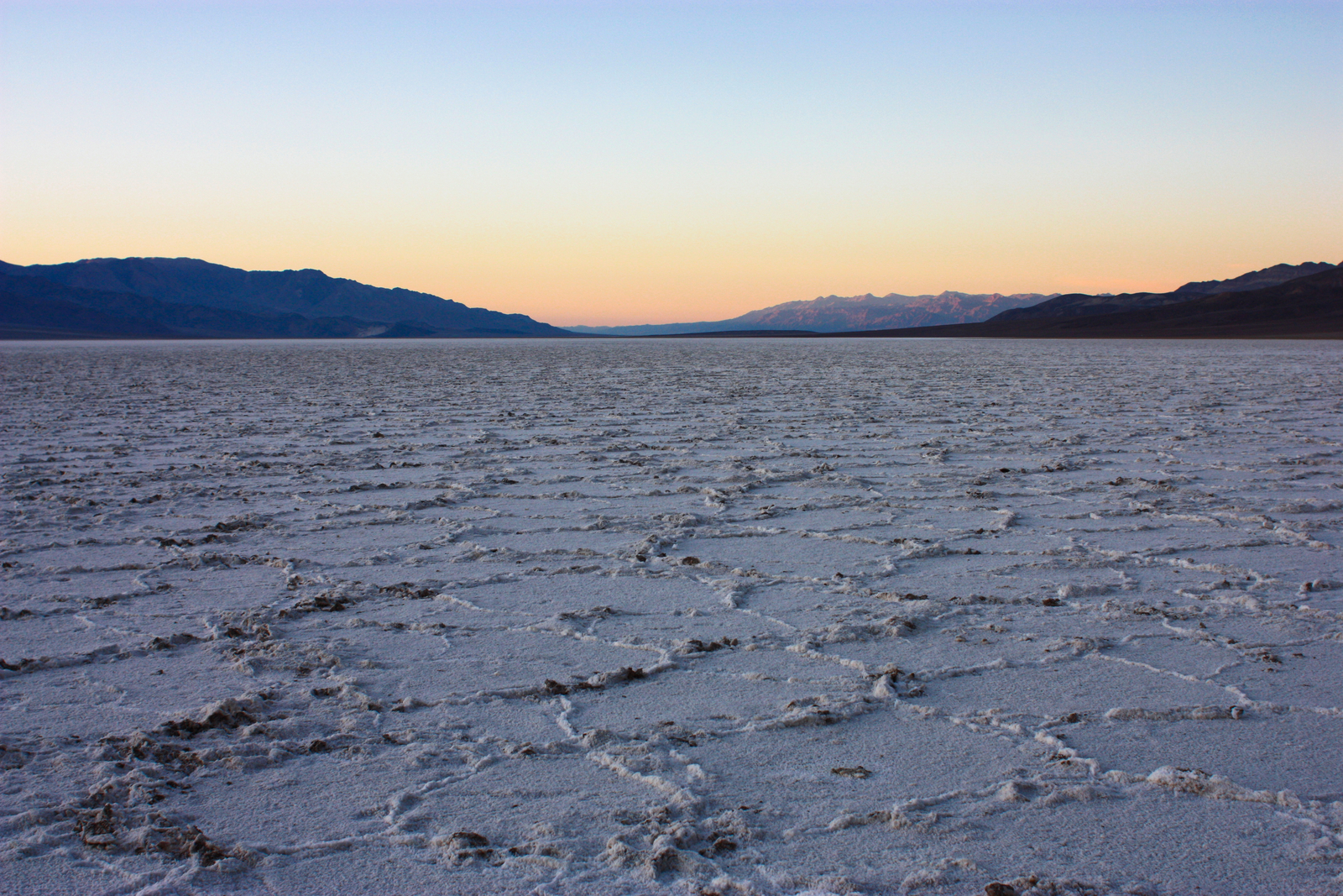
Description: The salt flats at Badwater defend Lake Manly's legacy. As the ancient lake evaporated, the minerals in the water remained, creating the massive salt pan seen stretching to the horizon. Occasionally dampened by rainfall (~1.9 inches/year), the hexagonal patterns on the surface are formed when the moisture evaporates, and the salt crystals expand during the drying process. At 282 feet below sea level, Badwater Basin is the lowest point in North America.
Title: Badwater Basin - Flickr - Joe Parks
Credit: Badwater Basin
Author: Joe Parks from Berkeley, CA
Usage Terms: Creative Commons Attribution 2.0
License: CC BY 2.0
License Link: https://creativecommons.org/licenses/by/2.0
Attribution Required?: Yes
Image usage
The following page links to this image:
