
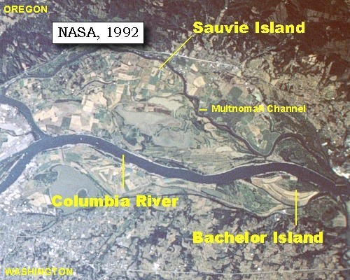
Image: Bachelor and Sauvie Island map
No higher resolution available.
Bachelor_and_Sauvie_Island_map.jpg (500 × 400 pixels, file size: 89 KB, MIME type: image/jpeg)
Description: Map created from satellite image looking south at Sauvie Island and Bachelor Island in the Columbia River
Title: Bachelor and Sauvie Island map
Credit: U.S. Geological Survey, scroll down to "Along the Journey - March 29, 1806"
Author: NASA
Usage Terms: Public domain
License: Public domain
Attribution Required?: No
Image usage
The following 2 pages link to this image:

All content from Kiddle encyclopedia articles (including the article images and facts) can be freely used under Attribution-ShareAlike license, unless stated otherwise.