
Image: BBN NationalParks StateForest
Size of this preview: 409 × 600 pixels. Other resolutions: 164 × 240 pixels | 2,203 × 3,230 pixels.
Original image (2,203 × 3,230 pixels, file size: 1.25 MB, MIME type: image/jpeg)
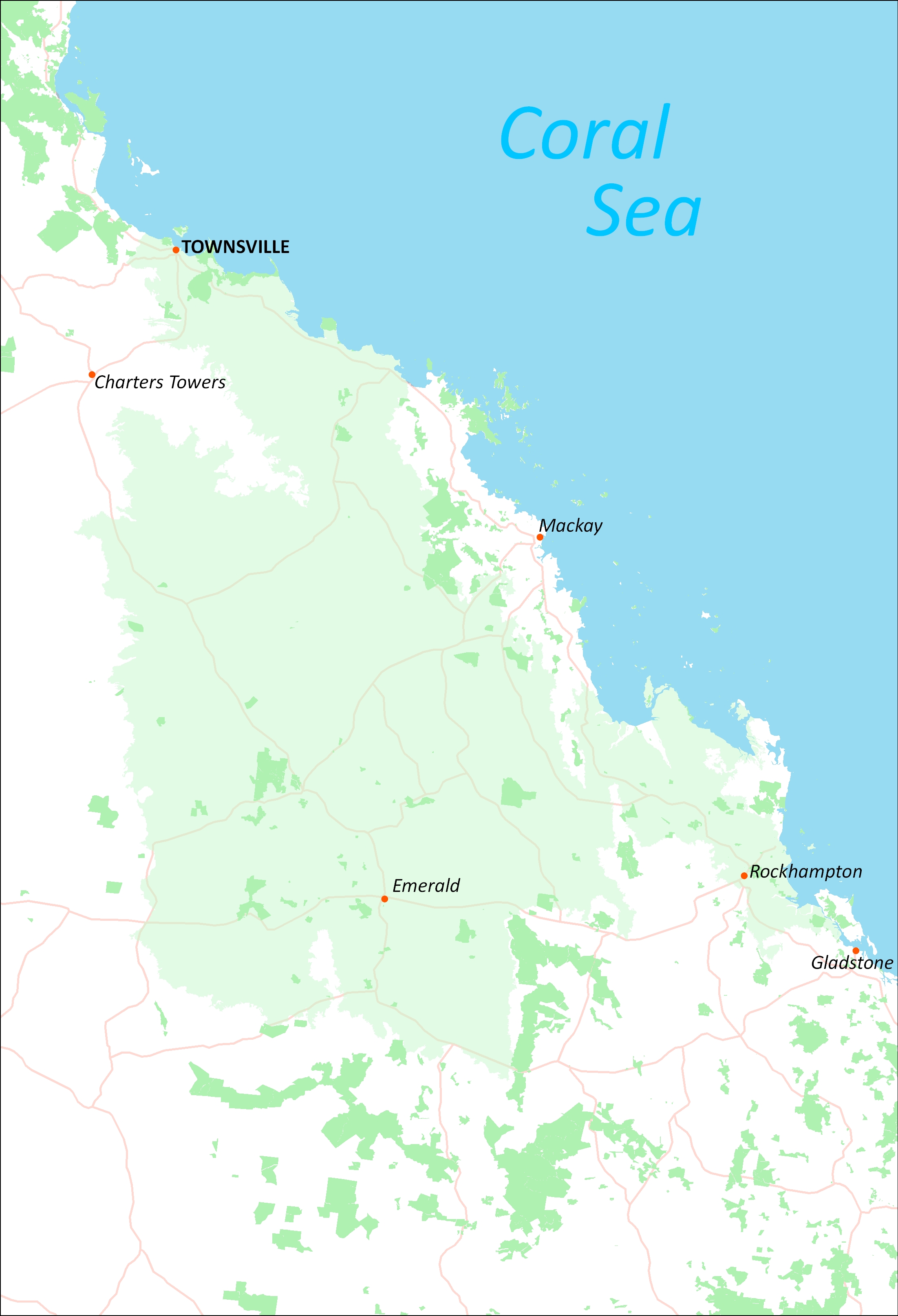
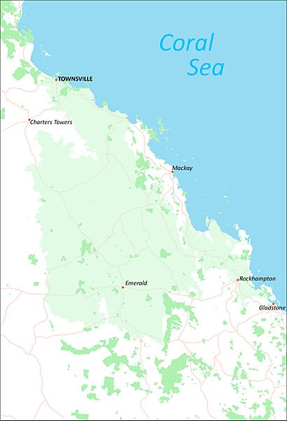
Description: This map graphic shows the extent of the Brigalow Belt North. This product was produced by the NQ Dry Tropics. Darker green areas of this product show areas of National Parks, State Forests, Forest Reserves and Nature Refuges
Title: BBN NationalParks StateForest
Credit: This product was created by Doug Willis of the NQ Dry Tropics.
Author: Freo1995 (talk)
Usage Terms: Creative Commons Attribution-ShareAlike 3.0
License: CC-BY-SA-3.0
License Link: https://creativecommons.org/licenses/by-sa/3.0/
Attribution Required?: Yes
Image usage
The following page links to this image:

All content from Kiddle encyclopedia articles (including the article images and facts) can be freely used under Attribution-ShareAlike license, unless stated otherwise.