
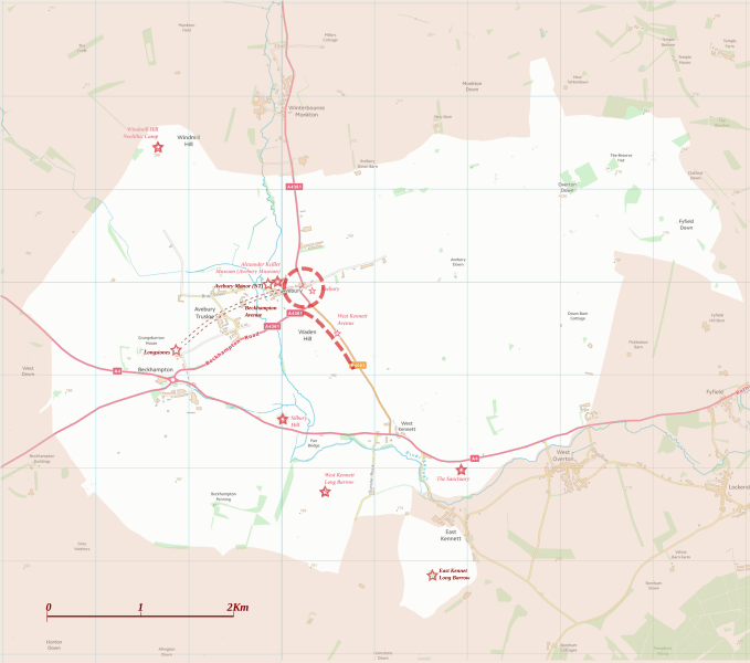
Image: Avebury World Heritage Site map

Size of this PNG preview of this SVG file: 679 × 599 pixels. Other resolution: 272 × 240 pixels.
Original image (SVG file, nominally 1,614 × 1,425 pixels, file size: 904 KB)
Description: Boundary and key sites on the Avebury section of the Stonehenge, Avebury and Associated Sites World Heritage Site
Title: Avebury World Heritage Site map
Credit: OS Open Data with additional material cited at World Heritage Site list No 373
Author: RobinLeicester building on OS OpenData VextorMap District Raster files
Usage Terms: Ordnance Survey OpenData Licence
License: OS OpenData
License Link: https://www.ordnancesurvey.co.uk/business-and-government/licensing/using-creating-data-with-os-products/os-opendata.html
Attribution Required?: Yes
Image usage
The following page links to this image:

All content from Kiddle encyclopedia articles (including the article images and facts) can be freely used under Attribution-ShareAlike license, unless stated otherwise.