
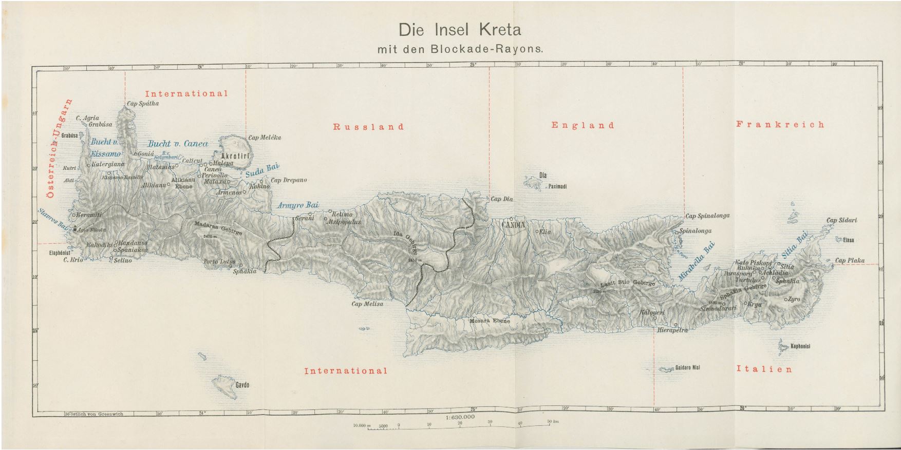
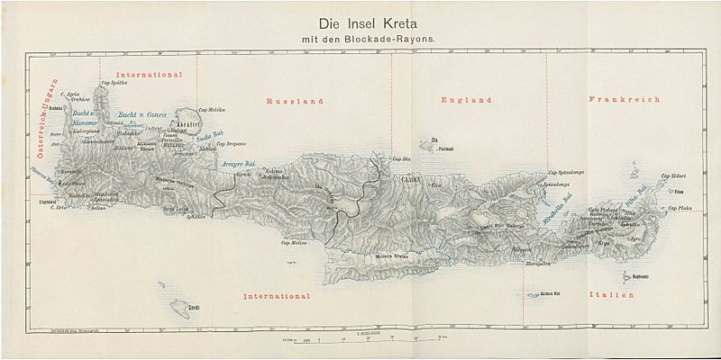
Image: Austro-Hungarian map of the blockade of Crete 1897
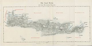
Size of this preview: 800 × 400 pixels. Other resolutions: 320 × 160 pixels | 1,754 × 877 pixels.
Original image (1,754 × 877 pixels, file size: 198 KB, MIME type: image/jpeg)
Description: Austro-Hungarian map of the International Squadron′s zones of blockading responsibilities around Crete in 1897.
Title: Austro-Hungarian map of the blockade of Crete 1897
Credit: The British in Crete, 1896 to 1913: Dividing Crete
Author: Unattributed
Usage Terms: Public domain
License: Public domain
Attribution Required?: No
Image usage
The following page links to this image:

All content from Kiddle encyclopedia articles (including the article images and facts) can be freely used under Attribution-ShareAlike license, unless stated otherwise.