
Image: Austrian Netherlands map-fr

Size of this PNG preview of this SVG file: 800 × 587 pixels. Other resolution: 320 × 235 pixels.
Original image (SVG file, nominally 3,912 × 2,872 pixels, file size: 457 KB)
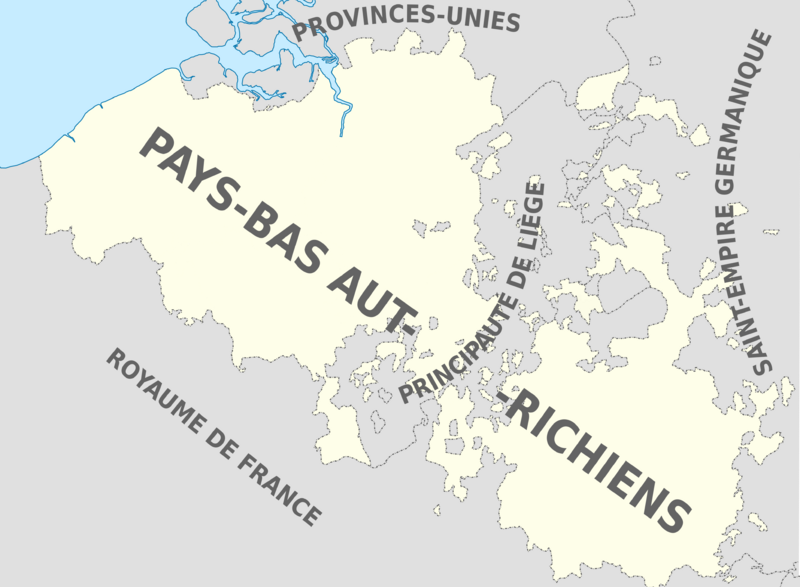
Description: Map showing Austrian Netherlands with provinces, as in 1789, in French. Based on : Faden, William "A map of the Austrian possessions in the Netherlands or Low Countries (1789), on David Rumsey Map collection
Title: Austrian Netherlands map-fr
Credit: Own work
Author: Sir Henry
Usage Terms: Creative Commons Attribution-Share Alike 3.0
License: CC BY-SA 3.0
License Link: https://creativecommons.org/licenses/by-sa/3.0
Attribution Required?: Yes
Image usage
The following page links to this image:

All content from Kiddle encyclopedia articles (including the article images and facts) can be freely used under Attribution-ShareAlike license, unless stated otherwise.