
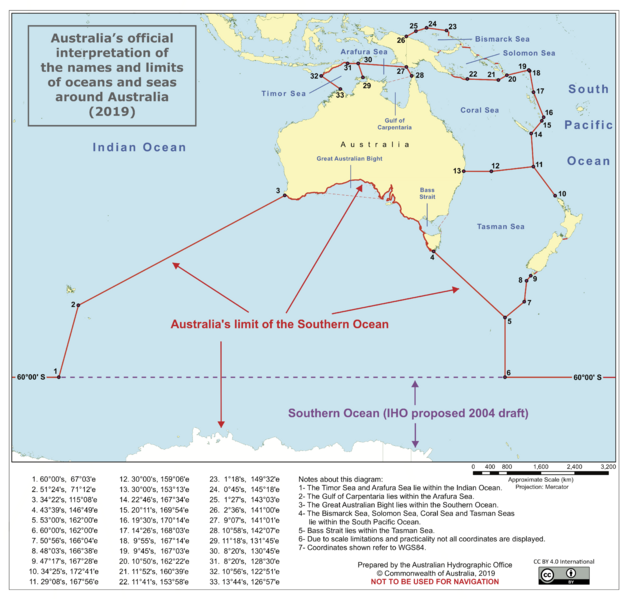
Image: Australia's official interpretation of the names and limits of oceans and seas around Australia

Size of this preview: 628 × 599 pixels. Other resolutions: 252 × 240 pixels | 4,960 × 4,733 pixels.
Original image (4,960 × 4,733 pixels, file size: 598 KB, MIME type: image/png)
Description: A map of Australia and its adjacent oceans, annotated with locations and notes describing the Australian Government's interpretation of the names and limits of oceans and seas around Australia
Title: Australia's official interpretation of the names and limits of oceans and seas around Australia
Credit: Australian Hydrographic Office (http://www.hydro.gov.au/factsheets/WFS_Names_and_Limits_of_Oceans_and_Seas_Around_Australia.pdf)
Author: Australian Department of Defence (Australian Hydrographic Office) officers.
Usage Terms: Creative Commons Attribution 4.0
License: CC BY 4.0
License Link: https://creativecommons.org/licenses/by/4.0
Attribution Required?: Yes
Image usage
The following page links to this image:

All content from Kiddle encyclopedia articles (including the article images and facts) can be freely used under Attribution-ShareAlike license, unless stated otherwise.