Image: Attack on Harper's Ferrypass5

Size of this preview: 526 × 600 pixels. Other resolutions: 210 × 240 pixels | 1,688 × 1,925 pixels.
Original image (1,688 × 1,925 pixels, file size: 2.69 MB, MIME type: image/jpeg)
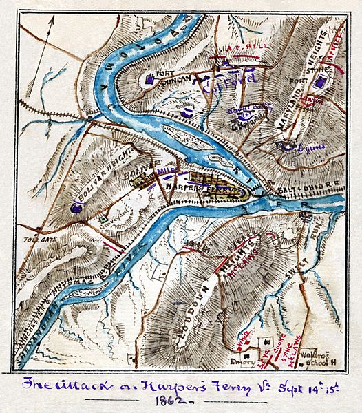
Description: Scan of a manuscript map by a Union Army mapmaker during the American Civil War. Shows the area surrounding Harper's Ferry, W. Va., at the intersection of the Potomac and Shenandoah Rivers as the Confederate forces under Jackson began their assault, Sept. 12-15, 1862.
Title: Attack on Harper's Ferrypass5
Credit: Library of Congress REPRODUCTION NUMBER Mss5:1 Sn237:1 v. 3 p. 809, In the Robert Knox Sneden Diary (Mss5:1 Sn237:1 v. 3, p. 809).
Author: Robert Knox Sneden
Usage Terms: Public domain
License: Public domain
Attribution Required?: No
Image usage
The following 2 pages link to this image:

All content from Kiddle encyclopedia articles (including the article images and facts) can be freely used under Attribution-ShareAlike license, unless stated otherwise.
