
Image: Atlantic Ocean slave location map by source and destination
Size of this preview: 491 × 599 pixels. Other resolutions: 197 × 240 pixels | 700 × 854 pixels.
Original image (700 × 854 pixels, file size: 74 KB, MIME type: image/png)
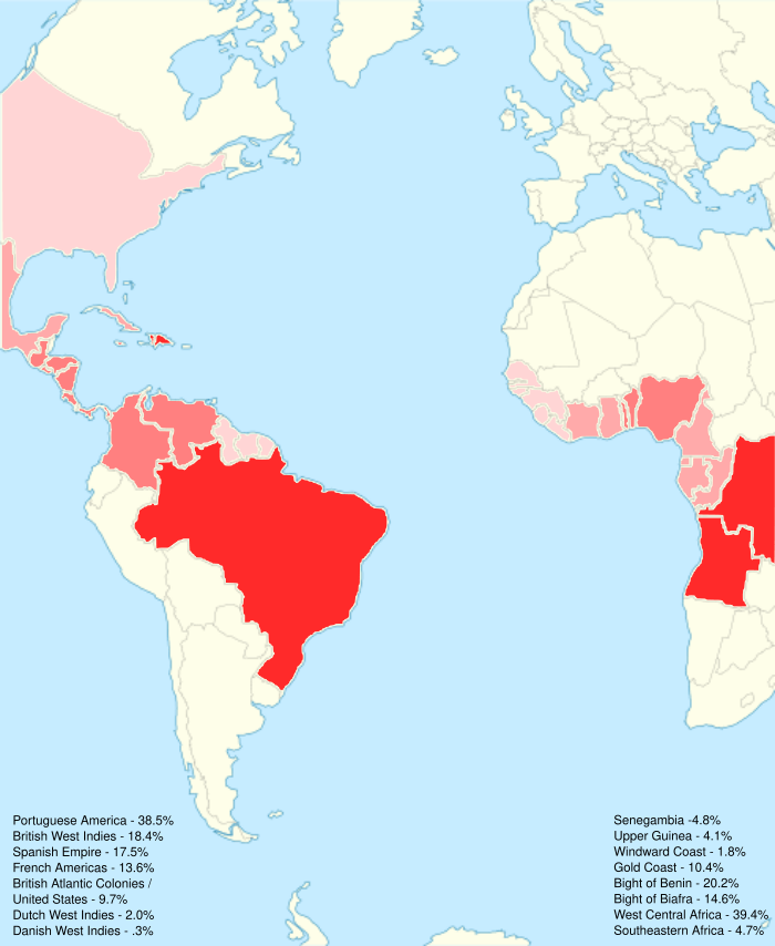
Description: Map shows both sides of the Atlantic including source and destination during the Transatlantic slave trade.
Title: Atlantic Ocean slave location map by source and destination
Credit: https://en.wikipedia.org/wiki/File:Atlantic_Ocean_location_map.svg
Author: Catrin
Permission: https://en.wikipedia.org/wiki/File:Atlantic_Ocean_location_map.svg
Usage Terms: Creative Commons Attribution-ShareAlike 4.0
License: CC-BY-SA-4.0
License Link: https://creativecommons.org/licenses/by-sa/4.0/
Attribution Required?: Yes
Image usage
The following page links to this image:

All content from Kiddle encyclopedia articles (including the article images and facts) can be freely used under Attribution-ShareAlike license, unless stated otherwise.