
Image: Asylum Avenue in 1865 - Washington DC
Size of this preview: 386 × 599 pixels. Other resolutions: 154 × 240 pixels | 900 × 1,397 pixels.
Original image (900 × 1,397 pixels, file size: 1.33 MB, MIME type: image/jpeg)
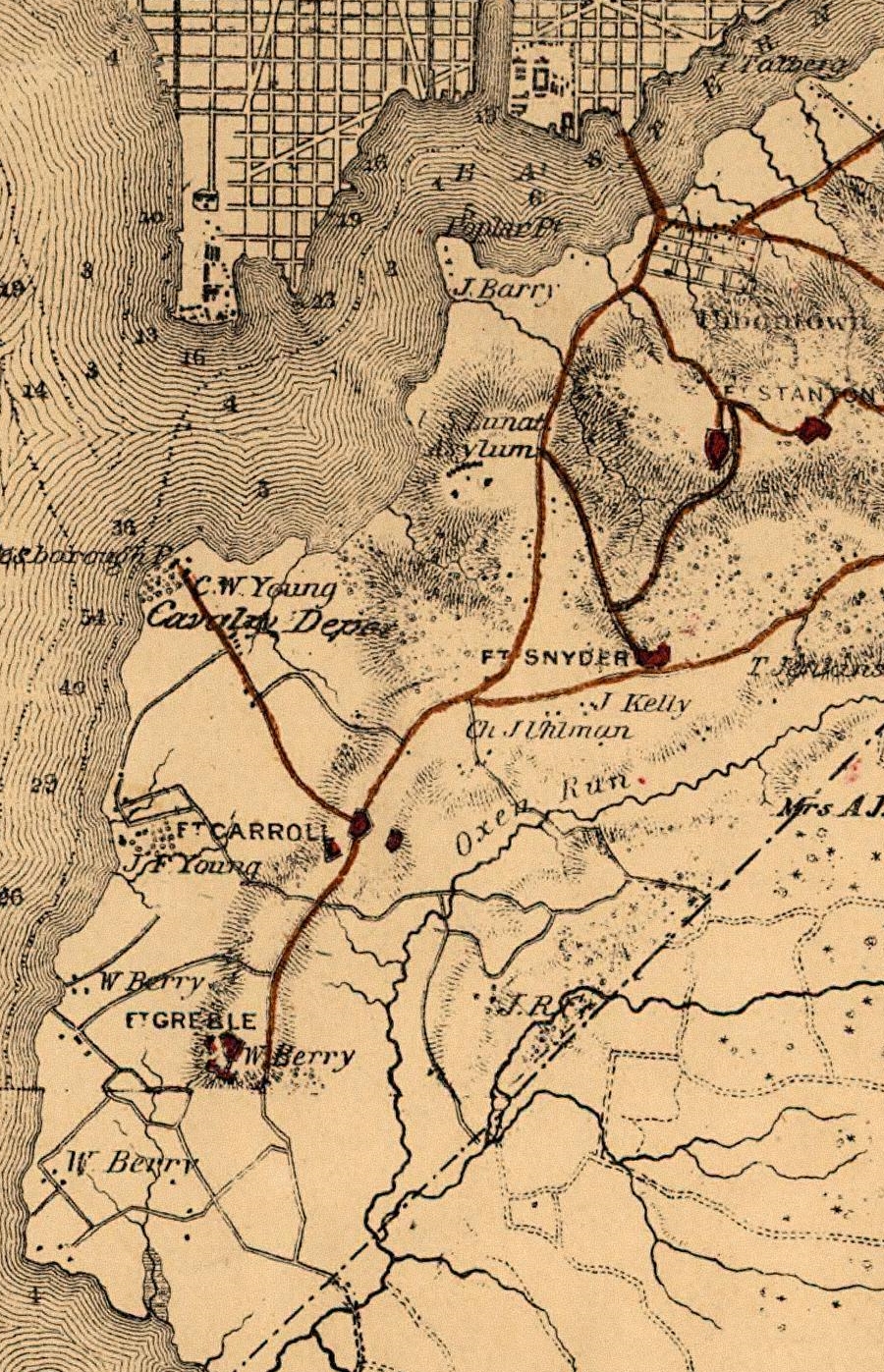
Description: Cropped map of the lower portion of southeast Washington, D.C., in the United States in 1865. The map depicts the location of two American Civil War forts, Fort Carroll and Fort Greble, atop a line of bluffs. Major improved roads used for defense of the city are marked in red. The road just east of the line of bluffs is Asylum Avenue.
Title: Asylum Avenue in 1865 - Washington DC
Credit: Division of Maps, Library of Congress
Author: Engineer Bureau, U.S. Department of War
Usage Terms: Public domain
License: Public domain
Attribution Required?: No
Image usage
The following 2 pages link to this image:

All content from Kiddle encyclopedia articles (including the article images and facts) can be freely used under Attribution-ShareAlike license, unless stated otherwise.