
Image: Asser map

Size of this preview: 800 × 412 pixels. Other resolutions: 320 × 165 pixels | 1,188 × 612 pixels.
Original image (1,188 × 612 pixels, file size: 255 KB, MIME type: image/png)
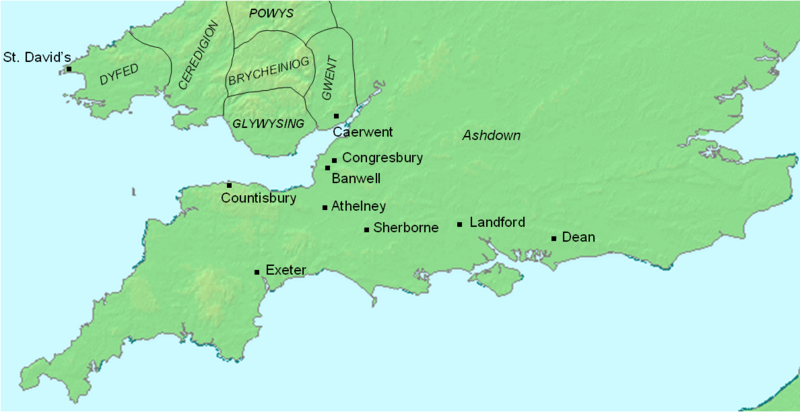
Description: Map of southwestern England and south Wales, showing places visited by Asser.
Title: Asser map
Credit: Own work using: DMIS: "We do not claim copyright on the images, so you can use them for Wikipedia." Abels, Alfred the Great, p. 350. Simon Keynes and Michael Lapidge, Alfred the Great, pp. 48–58, 93–96, and 220–221.
Author: Mike_Christie at English Wikipedia (Uploads)
Usage Terms: Public domain
License: Public domain
Attribution Required?: No
Image usage
The following page links to this image:

All content from Kiddle encyclopedia articles (including the article images and facts) can be freely used under Attribution-ShareAlike license, unless stated otherwise.