
Image: Arrondissement Bastogne Belgium Map
No higher resolution available.
Arrondissement_Bastogne_Belgium_Map.png (220 × 290 pixels, file size: 5 KB, MIME type: image/png)
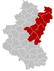
Description: Map of Bastogne District in province of Luxembourg, Belgium. Colors changed by me, based on work from w:nl:Gebruiker:LennartBolks/kaartenhoekje also in PD.
Title: Arrondissement Bastogne Belgium Map
Credit: Own work
Author: LennartBolks, colors by Nicnac25
Usage Terms: Public domain
License: Public domain
Attribution Required?: No
Image usage
The following page links to this image:

All content from Kiddle encyclopedia articles (including the article images and facts) can be freely used under Attribution-ShareAlike license, unless stated otherwise.