Image: Arktocara map

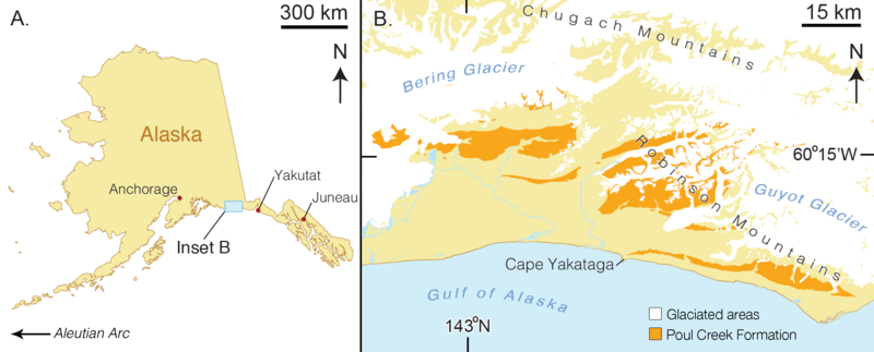
Description: Map of type locality for Arktocara yakataga (USNM 214830). (A) a map of the state of Alaska, showing major Alaskan cities. (B) simplified geologic map of the Yakutat City and Borough based on the USGS 1971 map by Don J. Miller (available at http://ngmdb.usgs.gov/Prodesc/proddesc_9402.htm). All exposures of the Poul Creek Formation in the Yakutat City and Borough (orange), are potential type localities for Arktocara yakataga (USNM 214830). Yellow represents exposures from all other lithological units, not mapped here.
Title: Arktocara map
Credit: Boersma, A. (2016). "Arktocara yakataga, a new fossil odontocete (Mammalia, Cetacea) from the Oligocene of Alaska and the antiquity of Platanistoidea". Peer J 4. DOI:10.7717/peerj.2321. PMC: 4991871.
Author: Alexandra Boersma and Nicholas Pyenson
Usage Terms: Creative Commons Attribution 4.0
License: CC BY 4.0
License Link: https://creativecommons.org/licenses/by/4.0
Attribution Required?: Yes
Image usage
The following page links to this image:

