
Image: April 12–13, 2020 tornado outbreak warnings and reports
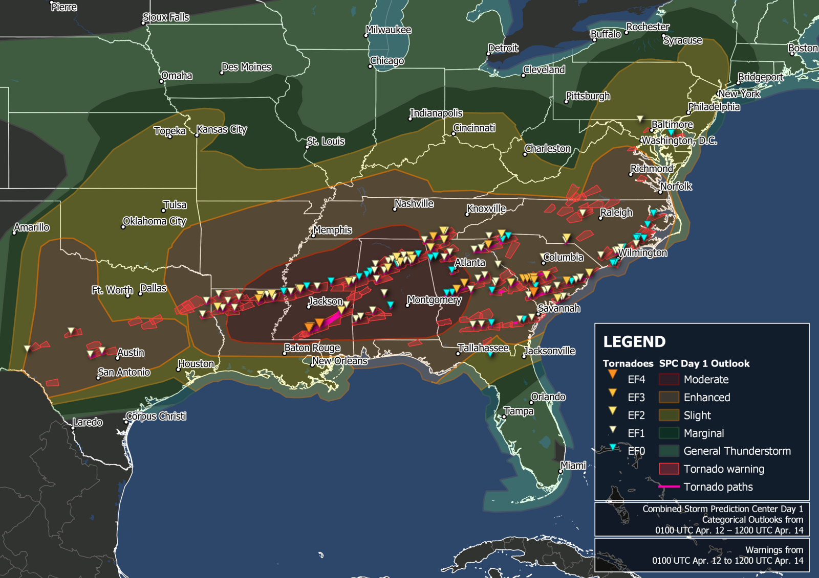
Description: Map of confirmed tornadoes and tornado warnings issued by the National Weather Service from April 12 through April 13, 2020, over the southeastern United States and tornadoes confirmed and surveyed by the National Weather Service. Map produced in QGIS with border outlines from the United States Census Bureau. National Weather Service warning outlines available from the Iowa Environmental Mesonet and tornado data available from the National Weather Service.
Title: April 12–13, 2020 tornado outbreak warnings and reports
Credit: Own work
Author: TheAustinMan
Usage Terms: Creative Commons Attribution-Share Alike 4.0
License: CC BY-SA 4.0
License Link: https://creativecommons.org/licenses/by-sa/4.0
Attribution Required?: Yes
Image usage
The following page links to this image:
