
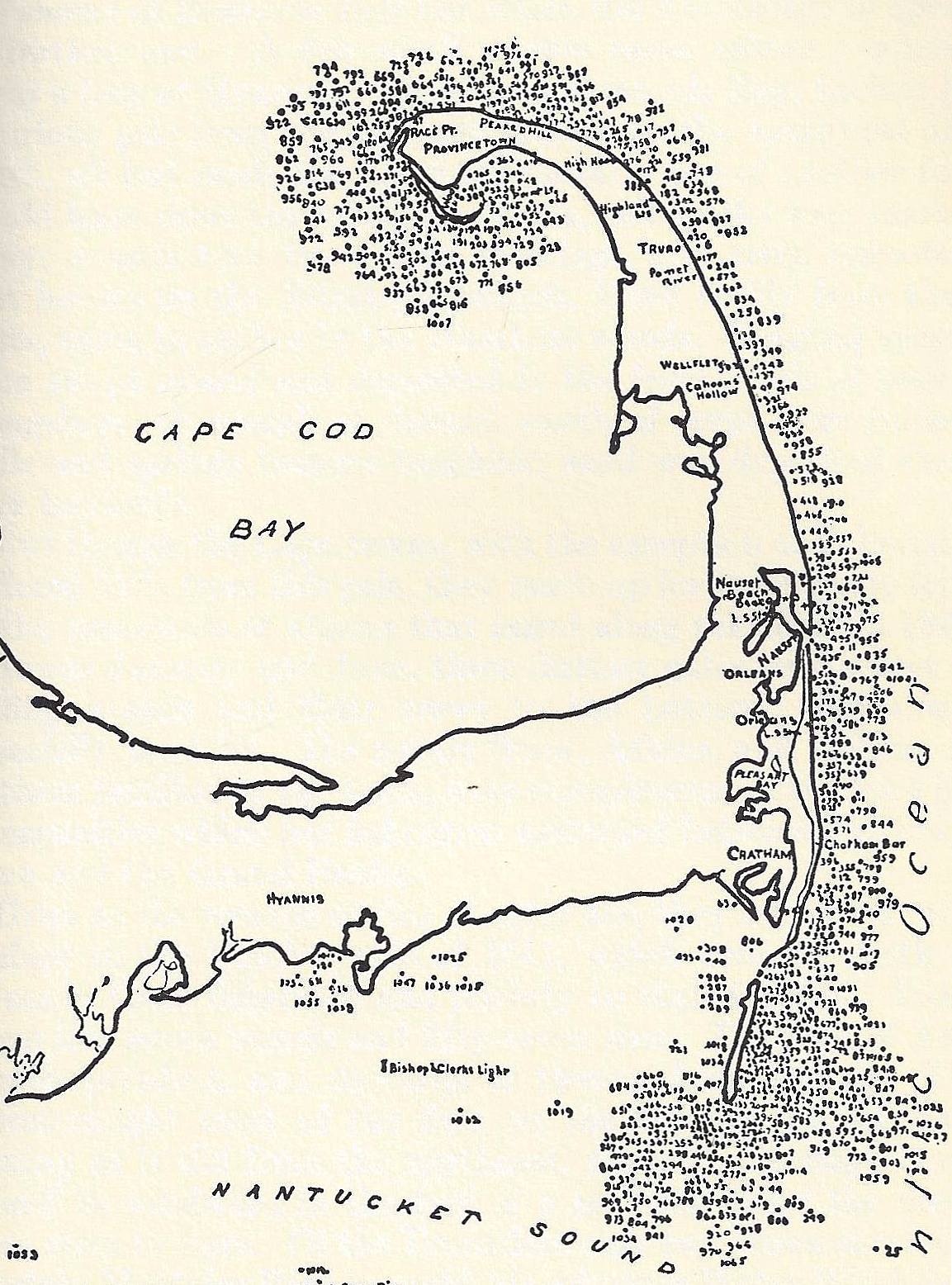
Image: Approximate Locations of Cape Cod Wrecks Down to 1903
Size of this preview: 444 × 599 pixels. Other resolutions: 178 × 240 pixels | 1,153 × 1,556 pixels.
Original image (1,153 × 1,556 pixels, file size: 273 KB, MIME type: image/jpeg)
Description: A map of Cape Cod annotated with the approximate locations of shipwrecks that were known as of 1903. This area, known as "The Graveyard of the Atlantic Ocean," is reported to have had over 3,000 wrecks. This is a section of a map drawn by the U.S. Engineer Office, Newport, RI.
Title: Approximate Locations of Cape Cod Wrecks Down to 1903
Credit: https://www.facebook.com/groups/685622308169421/permalink/2112705165461121/, found in Cape Cod:Its People and their History, by Henry C. Kittredge (1930)
Author: United States Engineer Office, Newport, RI
Usage Terms: Public domain
License: Public domain
Attribution Required?: No
Image usage
The following page links to this image:

All content from Kiddle encyclopedia articles (including the article images and facts) can be freely used under Attribution-ShareAlike license, unless stated otherwise.