
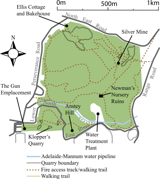
Image: Anstey Hill Recreation Park map

Size of this PNG preview of this SVG file: 538 × 600 pixels. Other resolution: 215 × 240 pixels.
Original image (SVG file, nominally 1,394 × 1,554 pixels, file size: 242 KB)
Description: Map of Anstey Hill recreation park, Adelaide, South Australia. Detail and layout taken from: A brochure on the park (Dept for Environment and Heritage 2006) 2000 UBD street directory Path of the pipeline approximated from Google earth
Title: Anstey Hill Recreation Park map
Credit: Own work
Author: Peripitus
Usage Terms: Creative Commons Attribution-Share Alike 4.0
License: CC BY-SA 4.0
License Link: https://creativecommons.org/licenses/by-sa/4.0
Attribution Required?: Yes
Image usage
The following page links to this image:

All content from Kiddle encyclopedia articles (including the article images and facts) can be freely used under Attribution-ShareAlike license, unless stated otherwise.