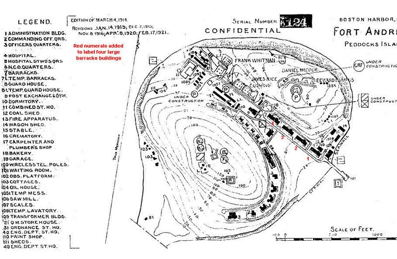
Image: Andrews map

Size of this preview: 800 × 523 pixels. Other resolutions: 320 × 209 pixels | 909 × 594 pixels.
Original image (909 × 594 pixels, file size: 144 KB, MIME type: image/jpeg)
Description: This map of Ft. Andrews, updated to 1921, comes from the U.S. Engineers' Reports of Completed Works for the harbor defenses of Boston, MA, as contained on a DVD of original file copies from the National Archives digitized and supplied by the Coast Defense Study Group, McLean, VA, 2010. The red numerals were added in 2010 by Paul Grigorieff to distinguish the four enlisted men's barracks.
Title: Andrews map
Credit: Own work by the original uploader
Usage Terms: Public domain
License: Public domain
Attribution Required?: No
Image usage
The following page links to this image:

All content from Kiddle encyclopedia articles (including the article images and facts) can be freely used under Attribution-ShareAlike license, unless stated otherwise.
