
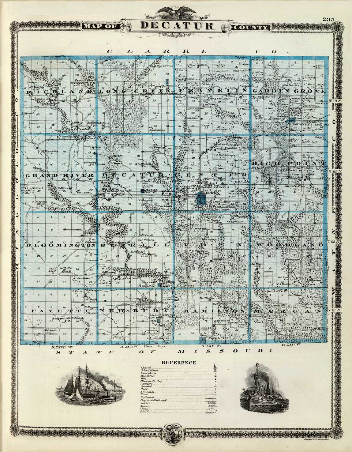
Image: Ancient Map of Decatur County, Iowa
Size of this preview: 467 × 599 pixels. Other resolutions: 187 × 240 pixels | 1,150 × 1,476 pixels.
Original image (1,150 × 1,476 pixels, file size: 1.05 MB, MIME type: image/jpeg)
Description: An old map of Decatur County, Iowa.
Title: Ancient Map of Decatur County, Iowa
Credit: A. T. Andreas’ Illustrated Historical Atlas of the State of Iowa. Published by the Andreas Atlas Co., Chicago 1875, p. 235
Author: Alfred Theodore Andreas (1839–1900)
Usage Terms: Public domain
License: Public domain
Attribution Required?: No
Image usage
The following page links to this image:

All content from Kiddle encyclopedia articles (including the article images and facts) can be freely used under Attribution-ShareAlike license, unless stated otherwise.