
Image: American Revolutionary War Cobleskill and Cherry Valley
Size of this preview: 800 × 531 pixels. Other resolutions: 320 × 212 pixels | 2,086 × 1,384 pixels.
Original image (2,086 × 1,384 pixels, file size: 543 KB, MIME type: image/jpeg)
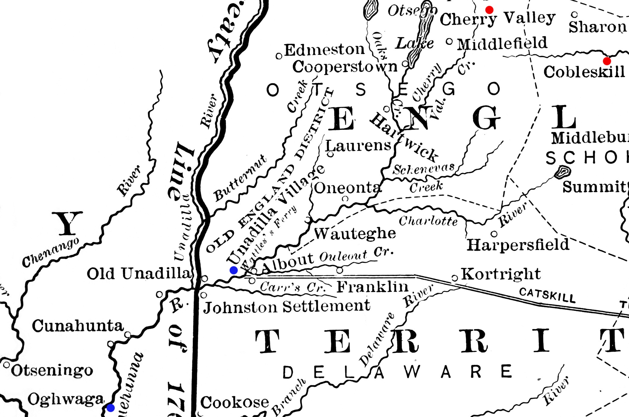
Description: Detail from a map showing a portion of New York's western frontier with the Iroquois. The New York communities of Cherry Valley and Cobleskill, the scenes of military actions in the American Revolutionary War in 1778, are highlighted in red. The Indian villages of Unadilla and Unaquaga (spelled "Oghwaga" on the map), which were destroyed in raids in 1778, are highlighted in blue.
Title: American Revolutionary War Cobleskill and Cherry Valley
Credit: Derived from File:Frontier of NY in Revolution.png
Author: Image author not specified; book author Francis Whiting Halsey (1815-1919)
Usage Terms: Public domain
License: Public domain
Attribution Required?: No
Image usage
The following 4 pages link to this image:

All content from Kiddle encyclopedia articles (including the article images and facts) can be freely used under Attribution-ShareAlike license, unless stated otherwise.