
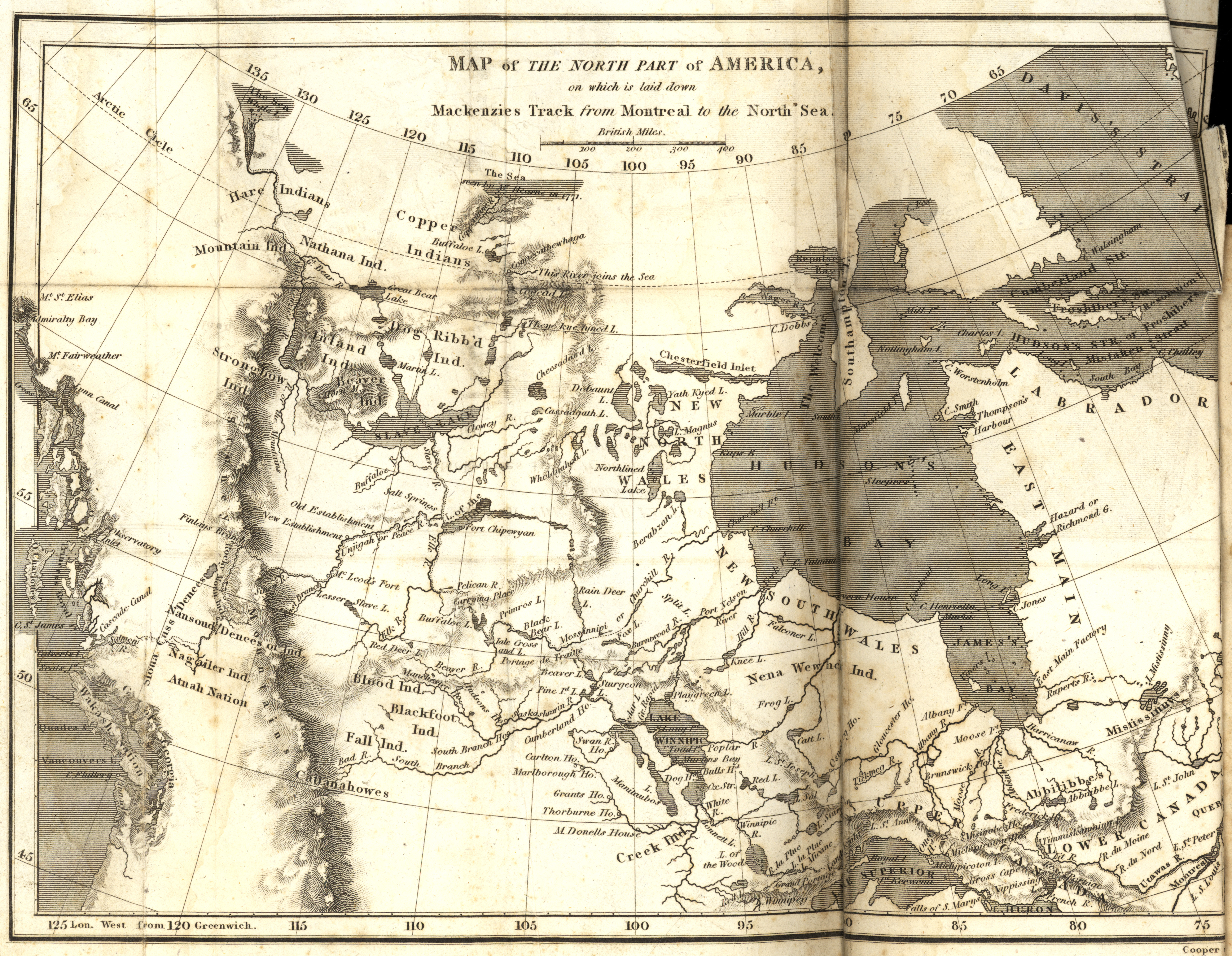
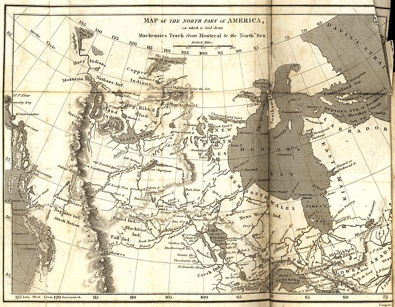
Image: Alexander Mackenzie map
Size of this preview: 773 × 600 pixels. Other resolutions: 310 × 240 pixels | 5,879 × 4,560 pixels.
Original image (5,879 × 4,560 pixels, file size: 9.24 MB, MIME type: image/jpeg)
Description: Mackenzie, Alexander. Map of the North Part of America on which is laid down Mackenzies Track from Montreal to the North Sea [map] Scale not given. In: A Collection of Voyages and Travels, from the Discovery of America to the Commencement of the Nineteenth Century (Volume 24). London: 1809. Image Courtesy of University of Manitoba Archives & Special Collections
Title: Alexander Mackenzie map
Credit: Map of the North Part of America on which is laid down Mackenzies Track from Montreal to the North Sea (1809)
Author: Manitoba Historical Maps
Usage Terms: Creative Commons Attribution 2.0
License: CC BY 2.0
License Link: http://creativecommons.org/licenses/by/2.0
Attribution Required?: Yes
Image usage
The following 2 pages link to this image:

All content from Kiddle encyclopedia articles (including the article images and facts) can be freely used under Attribution-ShareAlike license, unless stated otherwise.