
Image: AlbiaMines
Size of this preview: 800 × 510 pixels. Other resolutions: 320 × 204 pixels | 1,229 × 784 pixels.
Original image (1,229 × 784 pixels, file size: 197 KB, MIME type: image/png)
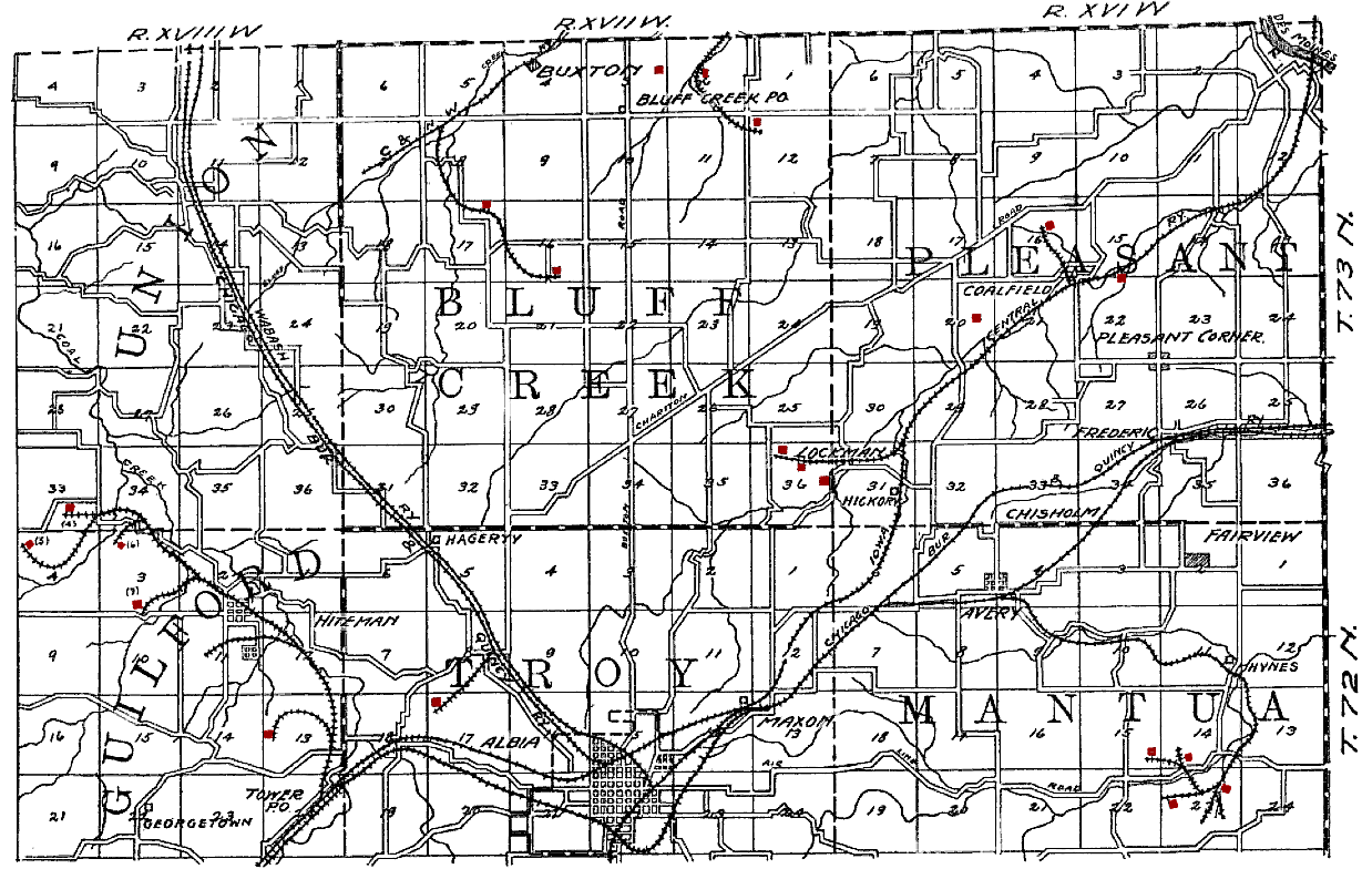
Description: Original caption: "PLATE VIII. Map showing mines in northern Monroe county." The city is en:Albia, Iowa. Mines have been tinted red by the uploader. The railroads shown on the map are: CRI&P en:Chicago, Burlington and Quincy Railroad, CB&Q en:Wabash Railroad, CM&StP en:Chicago and North Western Railway, and en:Iowa Central Railway. Former coal mining camps include Hiteman, Buxton, Bluff Creek, Lockman, Coalfield and Hynes.
Title: AlbiaMines
Credit: The Coal Deposits of Iowa, Chapter I of Iowa Geological Survey Annual Report, 1908
Author: Henry Hinds
Usage Terms: Public domain
License: Public domain
Attribution Required?: No
Image usage
The following page links to this image:

All content from Kiddle encyclopedia articles (including the article images and facts) can be freely used under Attribution-ShareAlike license, unless stated otherwise.