
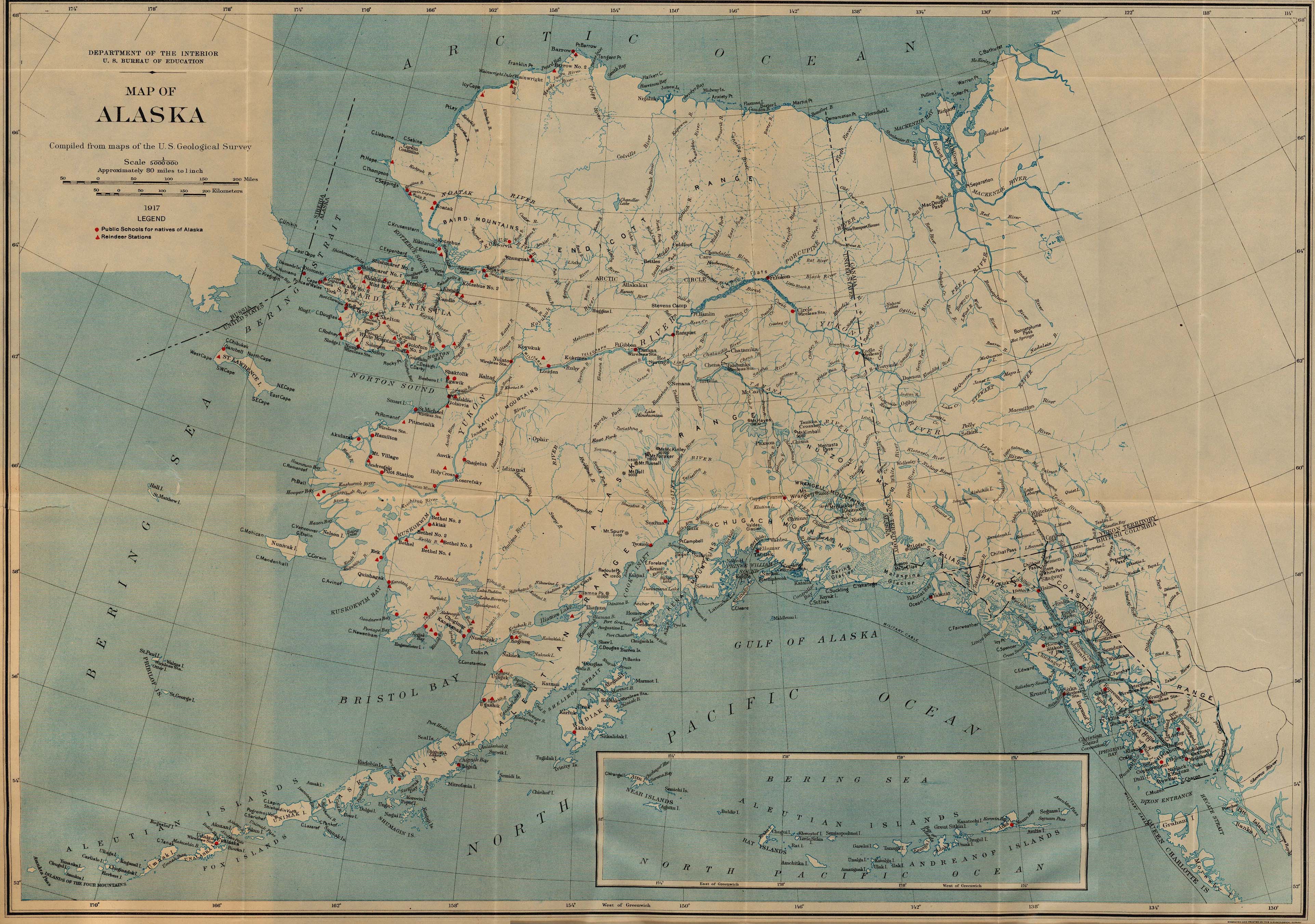
Image: Alaska stations 1917
Size of this preview: 800 × 562 pixels. Other resolutions: 320 × 225 pixels | 3,845 × 2,703 pixels.
Original image (3,845 × 2,703 pixels, file size: 1.76 MB, MIME type: image/jpeg)
Description: Map showing government schools for Alaska natives, and reindeer stations, as of 1917. Railroads, telegraph and cable lines, and wireless stations are also shown.
Title: Alaska stations 1917
Credit: [1] [http://www.lib.utexas.edu/maps/alaska.html Perry-Castañeda Library Map Collection, University of Texas at Austin
Author: United States Department of Interior, Bureau of Education
Usage Terms: Public domain
License: Public domain
Attribution Required?: No
Image usage
The following page links to this image:

All content from Kiddle encyclopedia articles (including the article images and facts) can be freely used under Attribution-ShareAlike license, unless stated otherwise.