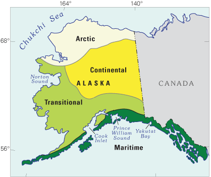
Image: Alaska climate regions USGS
Alaska_climate_regions_USGS.gif (418 × 351 pixels, file size: 17 KB, MIME type: image/gif)
Description: Schematic map showing a classification of modern-day climate zones in Alaska. This map is from a USGS website:Latest Wisconsin Deglaciation and Postglacial Vegetation Development in the Turnagain Arm Area, Upper Cook Inlet, South-Central Alaska
Title: Alaska climate regions USGS
Credit: http://esp.cr.usgs.gov/research/alaska/turnarm.html
Author: Thomas A. Ager and Paul E. Carrara, USGS
Usage Terms: Public domain
License: Public domain
Attribution Required?: No
Image usage
The following page links to this image:

All content from Kiddle encyclopedia articles (including the article images and facts) can be freely used under Attribution-ShareAlike license, unless stated otherwise.

