
Image: Al-Idrisi's map of the Mediterranean

Size of this preview: 800 × 502 pixels. Other resolutions: 320 × 201 pixels | 2,439 × 1,531 pixels.
Original image (2,439 × 1,531 pixels, file size: 2.72 MB, MIME type: image/jpeg)
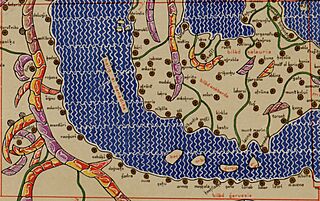
Description: Map of the Mediterranean from Tabula Rogeriana created by Arab geographer Muhammad al-Idrisi in 1154 and copied by Konrad Miller in 1929 who translitterated names in the roman alphabet. The map shows Croatia ("bilad garuasia"), Lombardy ("bilad ankbarda") and Calabria ("bilad kalauria").
Title: Al-Idrisi's map of the Mediterranean
Credit: Tabula Rogeriana
Author: Muhammad al-Idrisi (original map), Konrad Miller (copy)
Usage Terms: Public domain
License: Public domain
Attribution Required?: No
Image usage
The following page links to this image:

All content from Kiddle encyclopedia articles (including the article images and facts) can be freely used under Attribution-ShareAlike license, unless stated otherwise.