
Image: Akrotiri-Santorini volcanic-pumice Aegean-Sea Greece

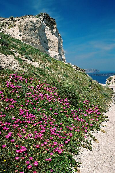
Description: Two layers of pumice, long time eroded, mined in quarries, and in one layer small scale rock intrusions of the great minoan, Late-Bronze-Age (3,5 ka) volcanic eruption of the caldera island Thera/Santorini (Minoan Eruption). The photo object is located at the north cliff face of Santorini’s southern peninsula, close to “Valos harbour (Λιμάνι Μπάλου)”, next to the modern village Akrotiri. The eruption soils, when weathered, are rich in minerals, thus fertile, plants of all kind (here: "Lampranthus spectabilis") flourish everywhere on the island - even the demanding wine plants (Santorini (wine)). Since 650 ka there were five mayor volcanic eruption series. The fifth mayor event series buried the advanced Minoan civilization under many meters of pumice. Only by 1967 archaeology began to dig out the exceptionally civilized prehistoric city called “Akrotiri)”. The findings were buried under layers of pumice like those in the photo.
Title: Akrotiri-Santorini volcanic-pumice Aegean-Sea Greece
Credit: Own work
Author: Ulrichstill
Usage Terms: Creative Commons Attribution-Share Alike 4.0
License: CC BY-SA 4.0
License Link: https://creativecommons.org/licenses/by-sa/4.0
Attribution Required?: Yes
Image usage
The following 2 pages link to this image:
