
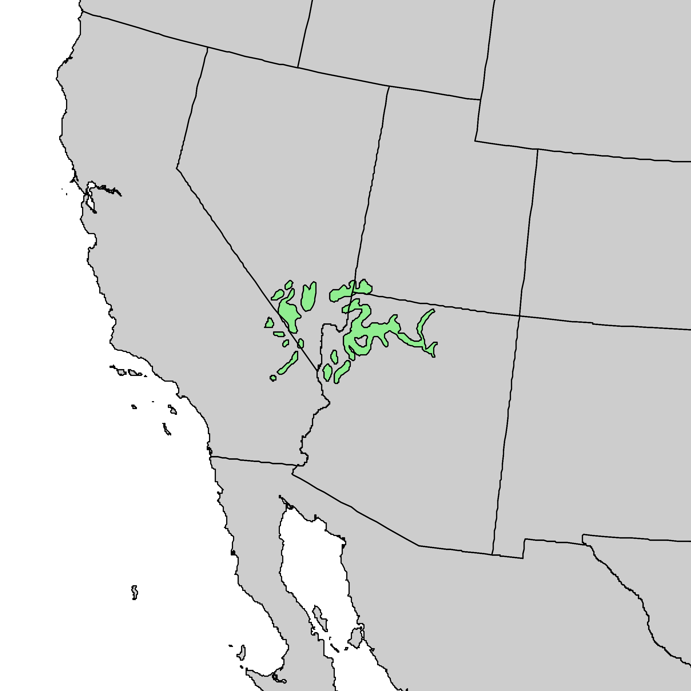
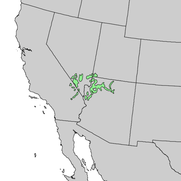
Image: Agave utahensis range map 1
Size of this preview: 600 × 600 pixels. Other resolutions: 240 × 240 pixels | 2,417 × 2,417 pixels.
Original image (2,417 × 2,417 pixels, file size: 57 KB, MIME type: image/png)
Description: Natural distribution map for Agave utahensis
Title: Agave utahensis range map 1
Credit: USGS Geosciences and Environmental Change Science Center: Digital Representations of Tree Species Range Maps from "Atlas of United States Trees" by Elbert L. Little, Jr. (and other publications)
Author: Benson & Darrow (1981)
Usage Terms: Public domain
License: Public domain
Attribution Required?: No
Image usage
The following page links to this image:

All content from Kiddle encyclopedia articles (including the article images and facts) can be freely used under Attribution-ShareAlike license, unless stated otherwise.