
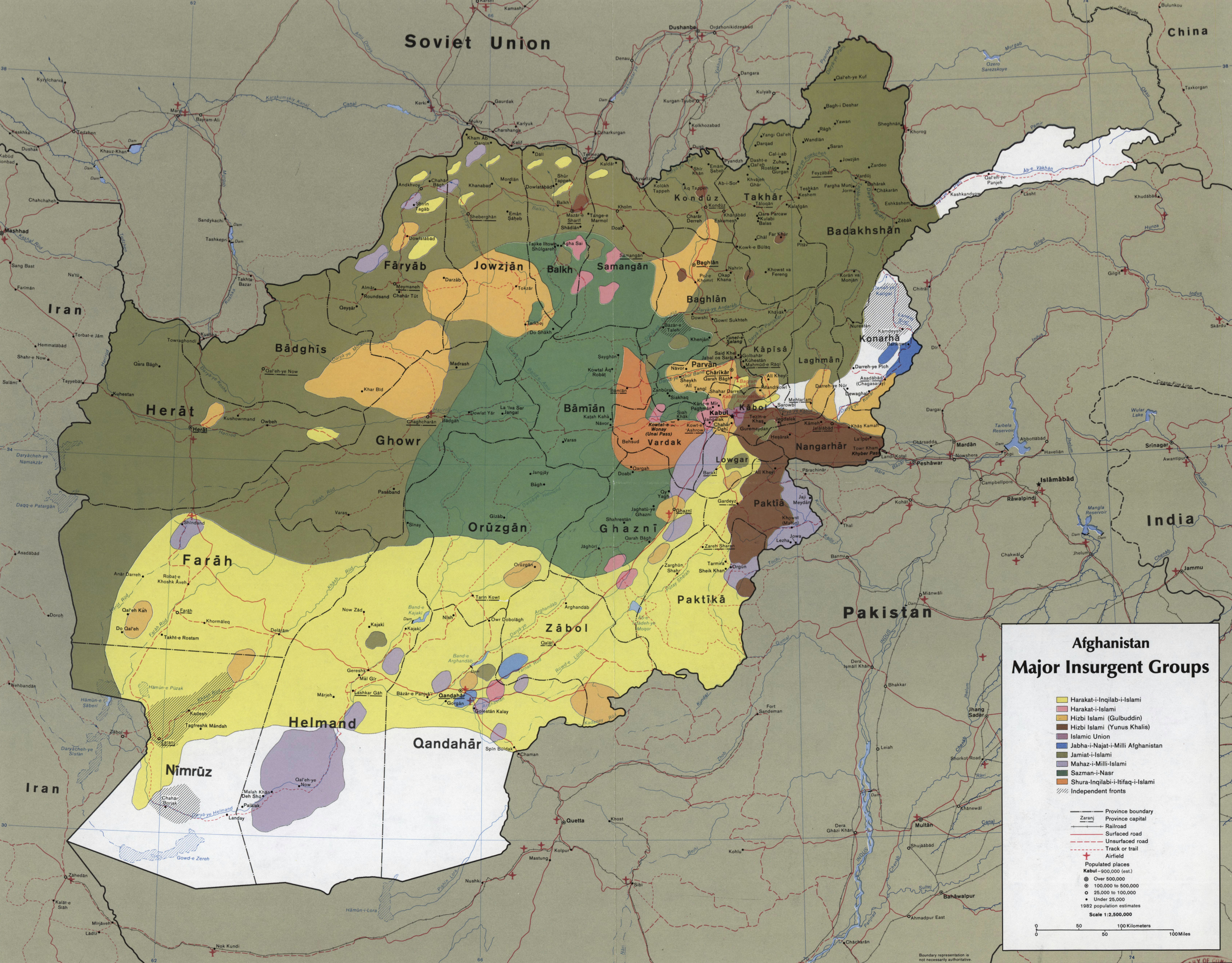
Image: Afghanistan insurgency 1985
Size of this preview: 767 × 599 pixels. Other resolutions: 307 × 240 pixels | 2,401 × 1,876 pixels.
Original image (2,401 × 1,876 pixels, file size: 4.18 MB, MIME type: image/jpeg)
Description: CIA map showing the areas where the main Mujahideen factions operated in 1985, during the Soviet war in Afghanistan. Scale 1:2,500,000 (E 600--E 750/N 380--N 290).
Title: Afghanistan insurgency 1985
Credit: This map is available from the United States Library of Congress's Geography & Map Division under the digital ID g7631r.ct001104. This tag does not indicate the copyright status of the attached work. A normal copyright tag is still required. See Commons:Licensing for more information.
Author: Central Intelligence Agency
Permission: US Federal publication, in public domain.
Usage Terms: Public domain
License: Public domain
Attribution Required?: No
Image usage
The following 2 pages link to this image:

All content from Kiddle encyclopedia articles (including the article images and facts) can be freely used under Attribution-ShareAlike license, unless stated otherwise.